



As a cold front and area of lower pressure approaches our region Tuesday, thunderstorms will pop. A slight chance some storms turn severe.
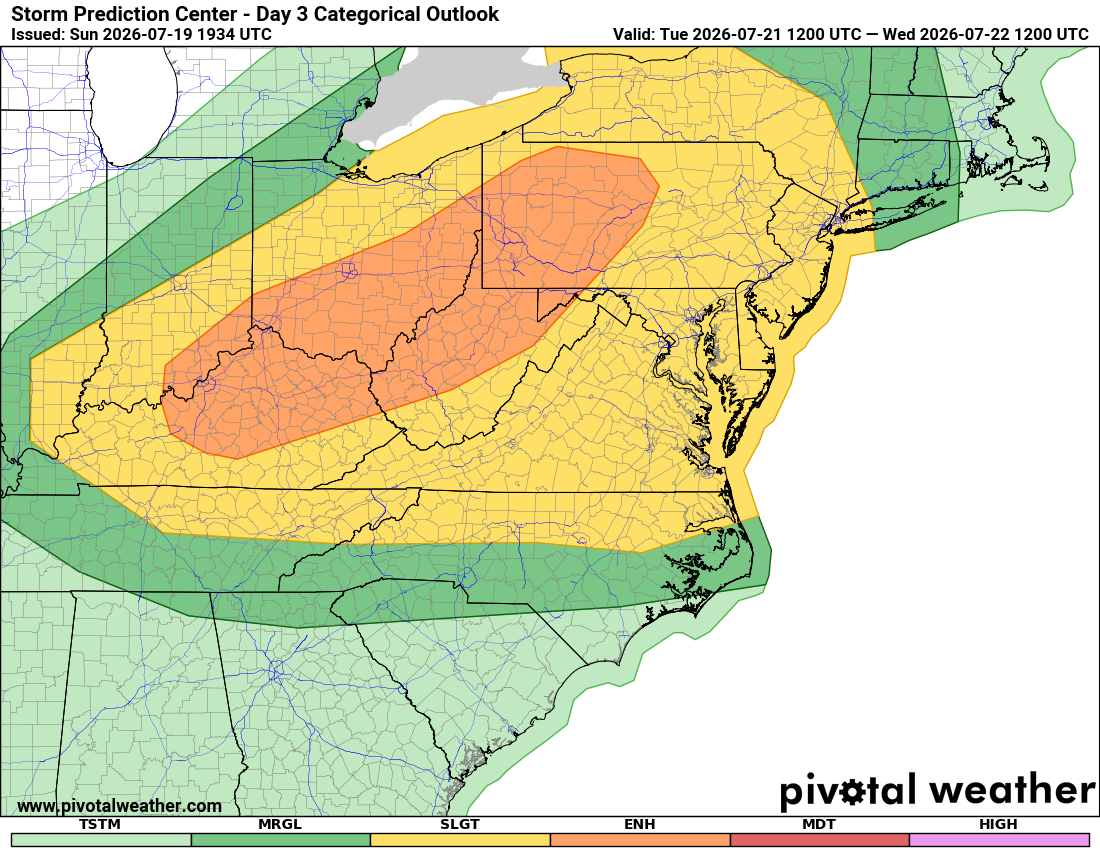
Some storms could produce damaging wind over 57 mph. The Storm Prediction Center flags this as a "slight" chance Tuesday afternoon, evening, and nighttime hours. Rain could get heavy as well.
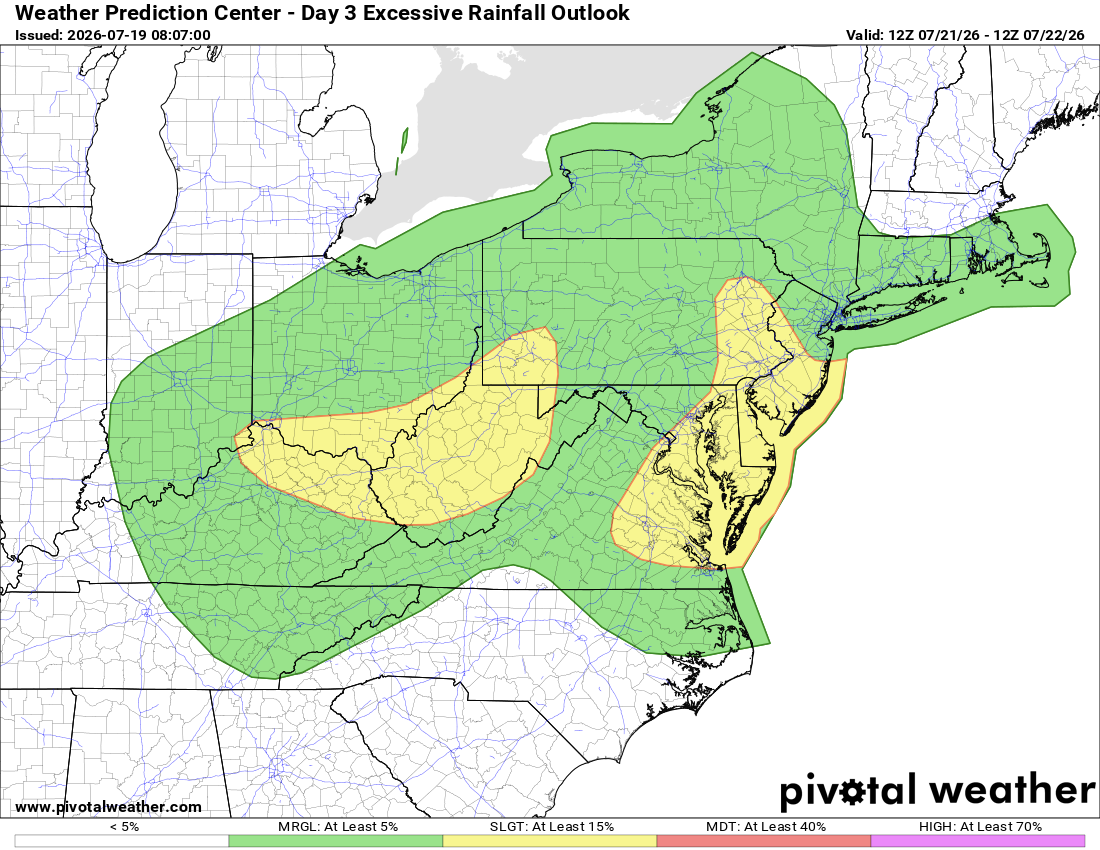
The Weather Prediction Center has the Beltway, I-95 corridor, and points east in a slight chance for heavy downpours that might cause flash flooding. Rain is generally welcome, just not too much too quickly.
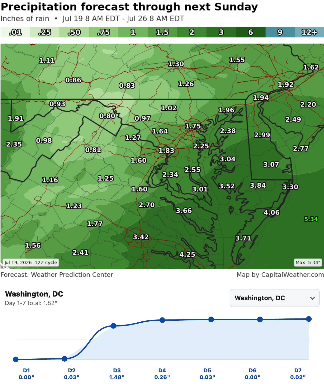
Forecast confidence is Medium since the timing and speed of the approaching cold front could still change the details of this forecast a bit. Atmospheric moisture is expected to be high, so expect noticeable humidity as well.


![Q&A: Decent Monday with less smoke. Humid Tuesday with severe storms possible [Sundays@7 Live Chat]](https://storage.ghost.io/c/9b/2a/9b2aed80-72a3-473a-aaf8-035d8a6ee8cb/content/images/size/w960/format/webp/2026/07/Screenshot-2026-07-19-at-18.39.44.png)


