



Numerous strong to severe thunderstorms are likely Tuesday afternoon and evening as ingredients for severe weather may come together.
The storms, most likely between 3 and 9 p.m., could produce damaging wind gusts capable of toppling trees. A few instances of flooding rain and hail are also possible, along with perhaps a tornado or two.
The National Weather Service has placed the area under a Level 3 out of 5 risk of severe storms. "Swaths of damaging winds still appear to be the greatest risk, though all hazards are possible," the agency wrote.
The setup features a surge of warm, very humid air Tuesday (with dew points climbing into the mid-70s), an approaching high-altitude disturbance and a trailing cold front. Together, they'll create "a favorable environment" for severe storms, the Weather Service wrote.
Damaging winds will most likely result from microbursts — intense, localized downdrafts within thunderstorms. While a brief tornado can't be ruled out anywhere in the region, the risk appears highest farther north, closer to a warm front extending through Pennsylvania.
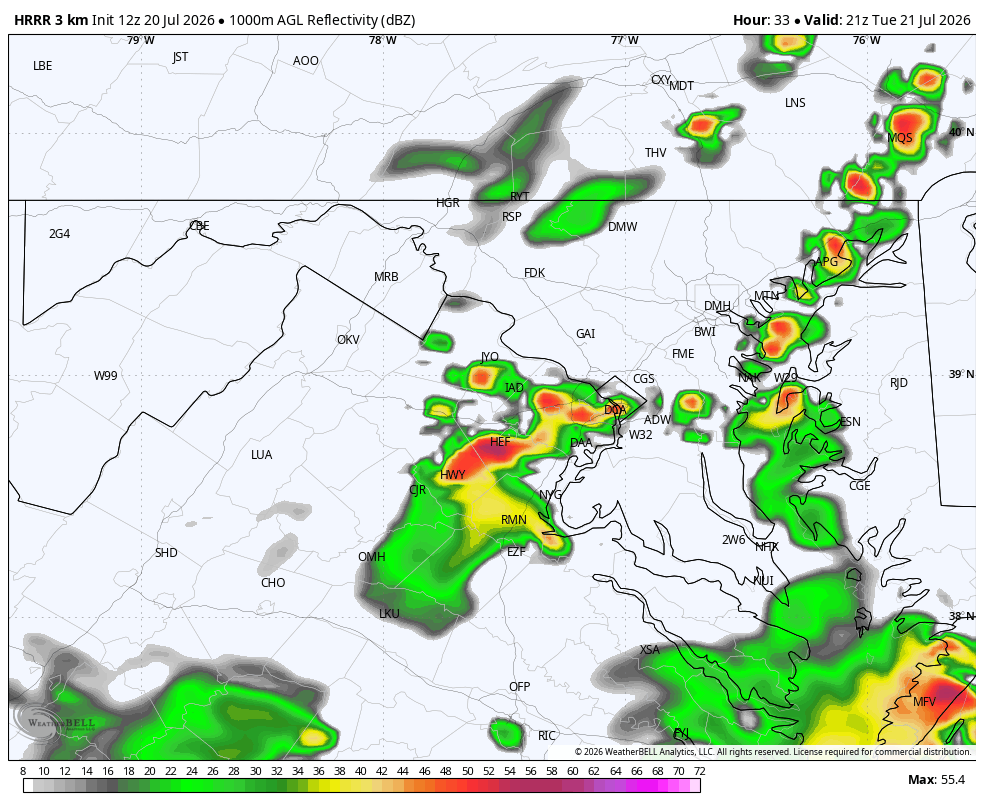
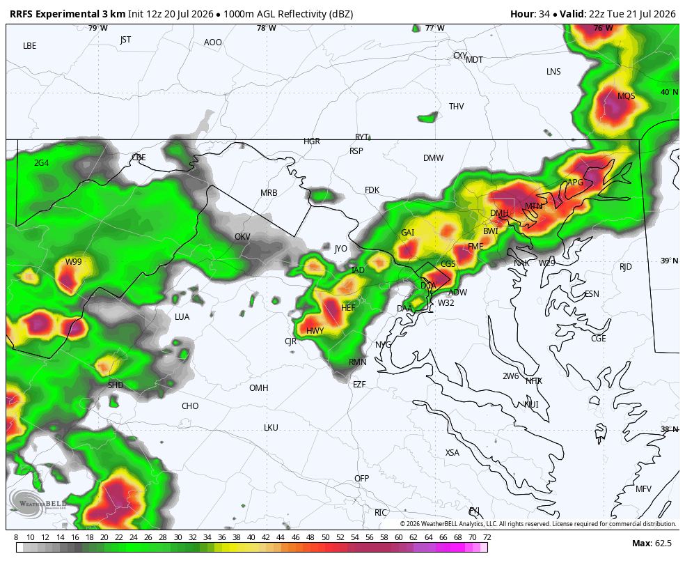
High-resolution computer models for tomorrow simulate a cluster of storms or a bowing line forming near the moutnains and sweeping over metro area between 4 and 7 p.m.
HRRR model forecast model at 5 p.m. Tuesday
RRFS model forecast radar at 6 p.m. Tuesday
Very high atmospheric moisture levels could also lead to localized flooding. After the first and potentially most intense round of storms Tuesday afternoon and evening, additional showers and thunderstorms may move through overnight.
As with most summertime thunderstorm events, some communities will be hit much harder than others, while some may see little or no severe weather. Storm intensity could also be limited if morning clouds and showers reduce the atmosphere's available energy.
There is the possibility of showers or even a thunderstorm during the Tuesday morning commute before the main action later in the day.
We'll have more updates on the storm threat on Tuesday.
Jeff Halverson contributed to this report.


![Q&A: Decent Monday with less smoke. Humid Tuesday with severe storms possible [Sundays@7 Live Chat]](https://storage.ghost.io/c/9b/2a/9b2aed80-72a3-473a-aaf8-035d8a6ee8cb/content/images/size/w960/format/webp/2026/07/Screenshot-2026-07-19-at-18.39.44.png)


