




The situation: Scattered severe storms swept through the area Saturday afternoon, producing heavy rain and some isolated damaging wind gusts and reports of hail. Some showers and storms remain possible into the evening, but should mostly stay below severe limits.
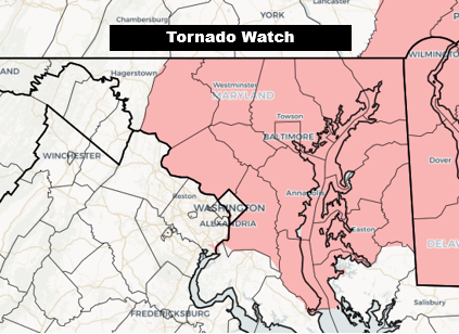
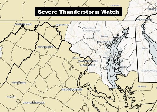
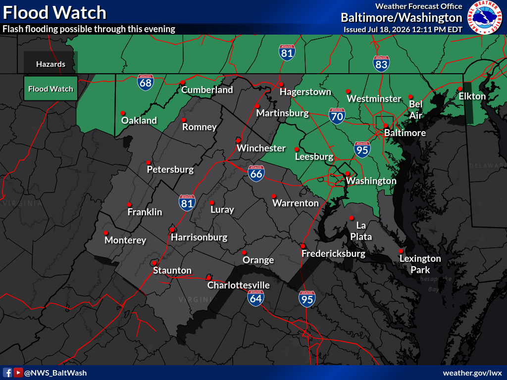
A tornado watch was posted for areas north and east of DC. The rest of the region was under severe thunderstorm and flood watches.
Scroll below live radar and warnings map for breaking updates...
5 p.m.: As severe weather is no longer affecting the region, we will discontinue updates unless heavy storms redevelop.
4:35 p.m.: While showers and storms are moving through DC's northern and western suburbs, all severe storm warnings have been dropped for the time being. These showers and storms should push through areas generally north of Route 50 over the next hour or two with some downpours and lightning, but winds will probably stay below severe limits for the most part.
Some good news as the rain passes: Air quality is improving. Most places are no longer code red and have shifted to code orange, yellow or even green.
4:15 p.m.: The intense storm near Baltimore produced a 61 mph gust at BWI Marshall Airport. That storm has also triggered a flood warning as it could produce 1 to 2 inches in an hour.
The other storm of note is in eastern Loudoun County and western Fairfax County. Sterling, Ashburn, and Reston should expect very heavy rain and the possibility of a damaging wind gust or two over the next 30 minutes. This storm is pushing to the east-northeast toward northern Fairfax County and southern Montgomery County.
3:50 p.m.: The most intense storm activity is passing through Columbia and Ellicott City toward Baltimore, where it should arrive by around 4 p.m. This storm contains extremely heavy rain and may also produce a few damaging wind gusts.
A new severe storm has developed in southern Loudoun County and is headed toward Leesburg over the next 30 minutes or so. It could produce hail and a few damaging wind gusts as well.
The storm in Fairfax County and D.C. is not as intense and is no longer considered severe by the National Weather Service. However, it will produce heavy rain and lightning as it continues progressing to the east and northeast through the Beltway area.
3:30 p.m.: Much of Fairfax County and D.C. will be affected by the severe storm currently over southern Fairfax County, near Burke, headed northeast, over the next hour or so. Isolated damaging wind gusts are possible, in addition to heavy rain and lightning.
3:20 p.m.: According to the National Weather Service, the storms in northern Maryland, between roughly Germantown and the Pennsylvania line, have been producing wind gusts up to 55 to 70 mph. This whole area of storms will head east-northeast toward Baltimore over the next hour or so. These storms also contain heavy rain and could produce a flooding threat. A flood warning has already been issued around Frederick.
3:05 p.m.: The two storms of most concern are in central Prince William and northern Montgomery counties where damaging wind gusts are possible. In Prince William County, the intense storm is about to hit Manassas and is headed toward southern Fairfax County while the storm in Montgomery County is about to hit Clarksburg and headed toward Damascus. Wind gusts over 60 mph and downed trees are possible here.
2:53 p.m.: The tornado warning in southern Frederick County and far northern Montgomery County as been canceled.
2:50 p.m.: A severe thunderstorm warning covers much of central Prince William County including the Manassas area, and small portions of southwest Fairfax and southeast Fauquier counties until 3:30 p.m. Damaging 60 mph wind gusts and quarter-size hail possible with this storm.
2:35 p.m.: A tornado warning for southern Frederick County into far northern Montgomery County, including Urbana and Damascus, is in effect until 3 p.m.
A larger portion of northwest Montgomery County is under a severe thunderstorm warning until 3:15 p.m. due to potential of damaging 70 mph wind gusts and hail the size of golf balls. This warning area includes Clarksburg and Damascus. Poolesville and Germantown are near the southern edge of the warning.
2:15 p.m.: Scattered storms are approaching the DC region from the west. Storms have already prompted severe thunderstorm warnings in the Winchester area, near Culpeper, in northern Loudoun County, and near Frederick, Md., all for the threat of damaging 60 mph wind gusts. The storm near Frederick may also produce hail and a tornado, the National Weather Service said.
A tornado watch is in effect until 9 p.m. for areas north and east of DC.
A severe thunderstorm watch is in effect for the rest of the region until 9 p.m.
Fueled by extremely high humidity (dew points in the mid-70s to as high as around 80), the potential for storms to produce torrential rain has prompted a flood watch for much of the region until 8 p.m.
The Weather Service issues a watch when the ingredients are in place for severe weather to develop. Warnings will be issued if a severe conditions are occurring or imminent.


![Q&A: Decent Monday with less smoke. Humid Tuesday with severe storms possible [Sundays@7 Live Chat]](https://storage.ghost.io/c/9b/2a/9b2aed80-72a3-473a-aaf8-035d8a6ee8cb/content/images/size/w960/format/webp/2026/07/Screenshot-2026-07-19-at-18.39.44.png)


