




1:00 a.m.: Several flood warnings are still in effect as shown below. Rain intensity has decreased a bit in many locations and should continue to do so the next couple of hours. But a few pockets of heavier rain, and an additional warning or two, are still possible.
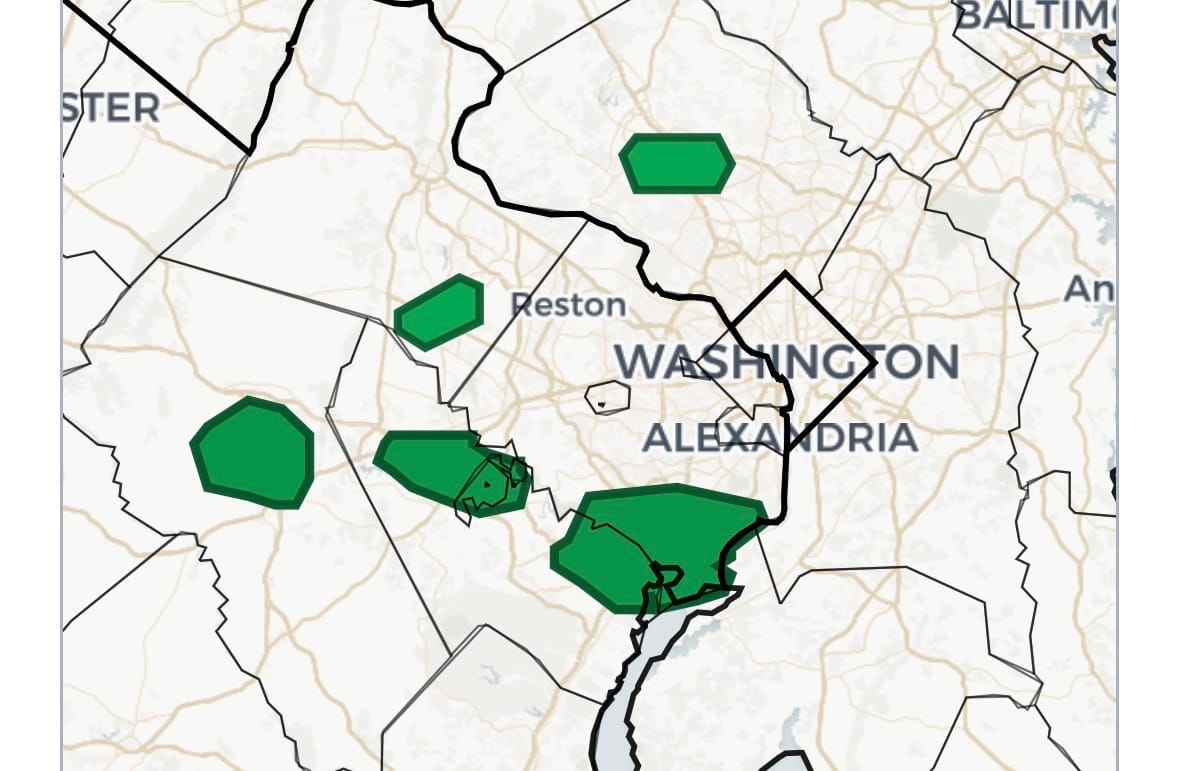
You can track the status of warnings through the night on our Weather Now page.
12:20 a.m.: New flash flood warning until 3:15 a.m. in southeast Prince William and southern Fairfax counties, including Lorton, Woodbridge, Lake Ridge, Fort Belvoir, and Dale City. Rainfall could total 3 to 5 inches in the warned area.
Flash Flood Warning including Dale City VA, Lake Ridge VA and Marumsco VA until 3:15 AM EDT pic.twitter.com/l6RWAeK969
— NWS Baltimore-Washington (@NWS_BaltWash) July 7, 2026
12:05 a.m.: Much of Prince William County is continuing to get hammered with torrential rain. This includes the area around Manassas, which has seen the following amounts of rain according to emergency management reports:
- 2.84 inches thus far and 0.22 inches in one minute on Youngs Branch at Manassas Battlefield
- 0.49 inches in 15 minutes and 3.12 inches in 3 hours at Rollins Ford Road
- 2 inches in 30 minutes at Independent Hill
11:35 p.m.: Flood warning for a portion of southern Loudoun County until 5:30 a.m. Per the National Weather Service, emergency management reported flooding along Fleetwood Rd. in Arcola along Broad Run. Heavy rainfall has come to an end, but small streams may still be rising. Some locations that will experience flooding include South Riding, Brambleton, and Arcola, including the following flood-prone roads: Evergreen Mills Road at Bluemont Ridge Road and Evergreen Mills Road at Arcola Road.

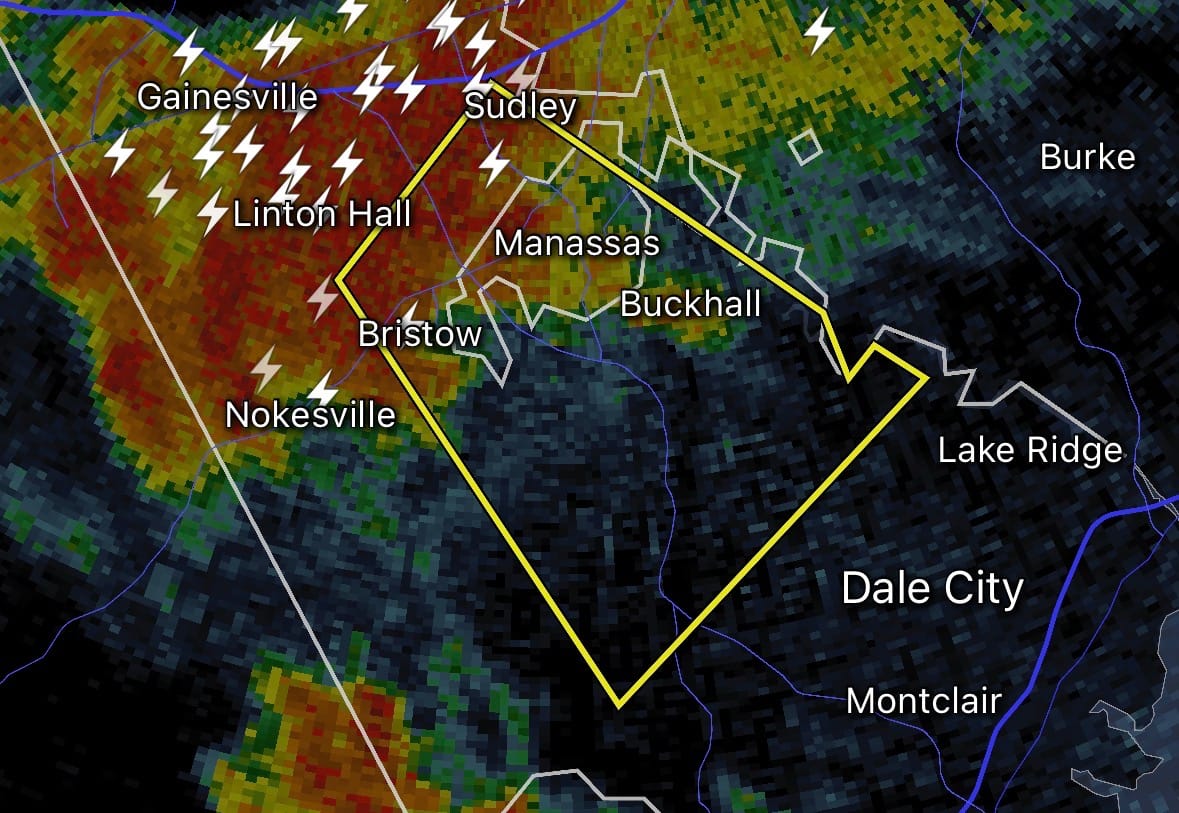
11:15 p.m.: Now we also have a flash flood warning in east-central Prince William County. Manassas is included in both the flash flood warning as well as the severe thunderstorm warning noted in the update immediately below. Total rainfall in the flash flood warning area, which includes Bull Run and Gainesville, could reach 3 to 6 inches. The warning runs until 2:15 a.m.
Flash Flood Warning including Manassas VA, Linton Hall VA and Buckhall VA until 2:15 AM EDT pic.twitter.com/6nEnbWWvYi
— NWS Baltimore-Washington (@NWS_BaltWash) July 7, 2026
11:00 p.m.: A severe thunderstorm warning is in effect for east-central Prince William County, including the Manassas area, until 11:30 p.m. due to potential for damaging 60 mph wind gusts.
10:40 p.m.: A flash flood warning has been issued for a portion of central Montgomery County covering Gaithersburg, North Potomac, Derwood, and Redland until 1:45 a.m. Radar indicates 2 to 3 inches have already fallen in the warning area with another 1 to 1.5 inches possible.
Flash Flood Warning including Gaithersburg MD, Redland MD and Derwood MD until 1:45 AM EDT pic.twitter.com/SMWf8K6uNp
— NWS Baltimore-Washington (@NWS_BaltWash) July 7, 2026
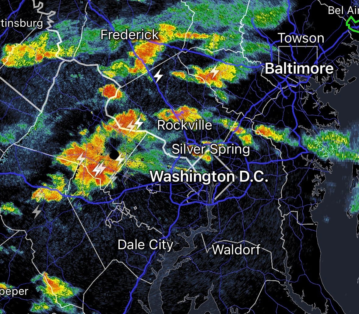
9:50 p.m.: Scattered storms with heavy rain and some lightning now cover much of the northern half of the region, mainly from I-66, DC, and Route 50 to the north. There are currently no flood warnings, but that could change any time given the slow-moving nature of the storms and an abundant amount of moisture in the atmosphere.
9:30 p.m.: The flash flood warning in northern Anne Arundel County has been canceled as the rain has let up there.
8:40 p.m.: Extremely heavy rain in northern Anne Arundel County has prompted a flash flood warning north of Annapolis until 11:45 p.m. The National Weather Service reported an instantaneous rainfall rate of 6 inches per hour in the warning area, which includes Severna Park (but that doesn’t necessarily mean it will rain at that rate for a full hour).
Flash Flood Warning including Severna Park MD, Pasadena MD and Arnold MD until 11:45 PM EDT pic.twitter.com/kgYTq355yx
— NWS Baltimore-Washington (@NWS_BaltWash) July 7, 2026
From earlier…
For the second straight day, the National Weather Service has issued a flood watch for the area, as scattered heavy storms are expected to produce torrential rainfall.
The watch is in effect from 4 p.m. through this evening. The latest computer models suggest storms will be most numerous between about 5 and 11 p.m. Like Sunday's storms, today's activity will probably be hit or miss, with some neighborhoods receiving very heavy rain while others see little or none.
"Multiple rounds of heavy rainfall are possible this afternoon and evening, some of which may occur over areas which recently experienced flooding rains," the Weather Service wrote. "Slow storm motions and repeat thunderstorm activity will occur within a tropical air mass. Hourly rainfall rates could push into the 2 to 3 inch range in the strongest storms, with an inch in 20 minutes possible."
On Sunday evening, 1.1 inches of rain fell in College Park in just 20 minutes. Storm totals exceeded 3.5 inches near the Montgomery-Howard county line north of Laytonsville.
Storms will tend to concentrate near a stalled front draped across the area.
In addition to heavy rain and lightning, a few storms could produce damaging wind gusts and small hail. The Weather Service has placed much of the area under a Level 1 of 5 risk for severe thunderstorms, while areas south and southwest of the Beltway are under a Level 2 of 5 risk.
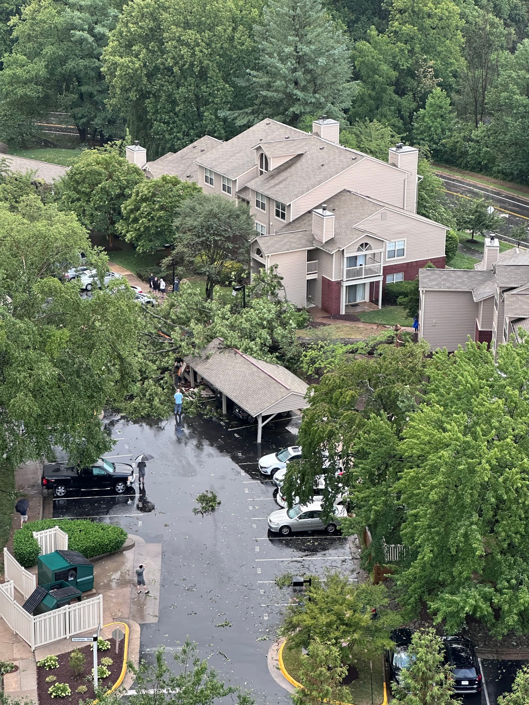
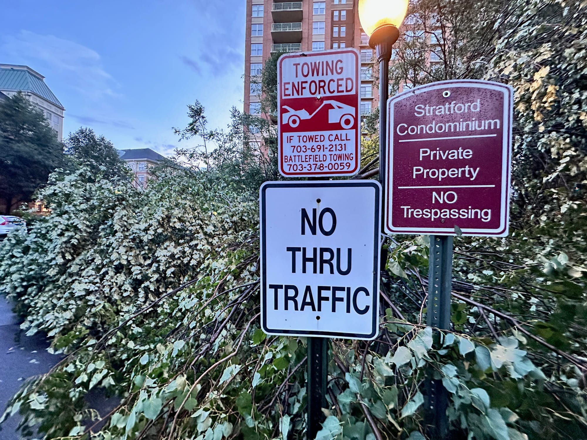
On Sunday evening, intense microburst winds brought down trees in Reston, Great Falls and Olney.
But heavy rain remains today's primary concern. Try to avoid driving during the heaviest storms. If you encounter water covering the roadway, remember: Turn around, don't drown. It's often impossible to judge how deep the water is, and vehicles can quickly become stranded or swept away.
Below, find a map highlighting Sunday's severe storm reports.
DC-area storm event summary for July 5
| Time | Value | Location | Notes |
|---|


![Q&A: Flood watch until 1am. Less hot, still humid this week. Watching storms [Sundays@7 Live Chat]](https://storage.ghost.io/c/9b/2a/9b2aed80-72a3-473a-aaf8-035d8a6ee8cb/content/images/size/w960/format/webp/2026/07/Screenshot-2026-07-05-at-18.49.22.png)


