



[Flood watch much of the area through 1 a.m. Tuesday]
Thanks to high levels of available moisture in the atmosphere, storms can bring ample downpours at times between Sunday night and Tuesday. Too much too quickly could produce flooding, especially in urban areas.
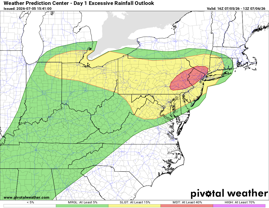
Even tomorrow midday into night could see some thunderstorms bring heavy downpours, especially along and east of Interstate 95. Downpours are just a bit more likely than high winds, but we shouldn't discount either severe threat.
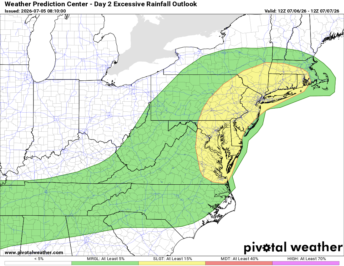
By Tuesday, the atmosphere's "juiciness" should decrease, leaving only a marginal chance of a flooding downpour or two.
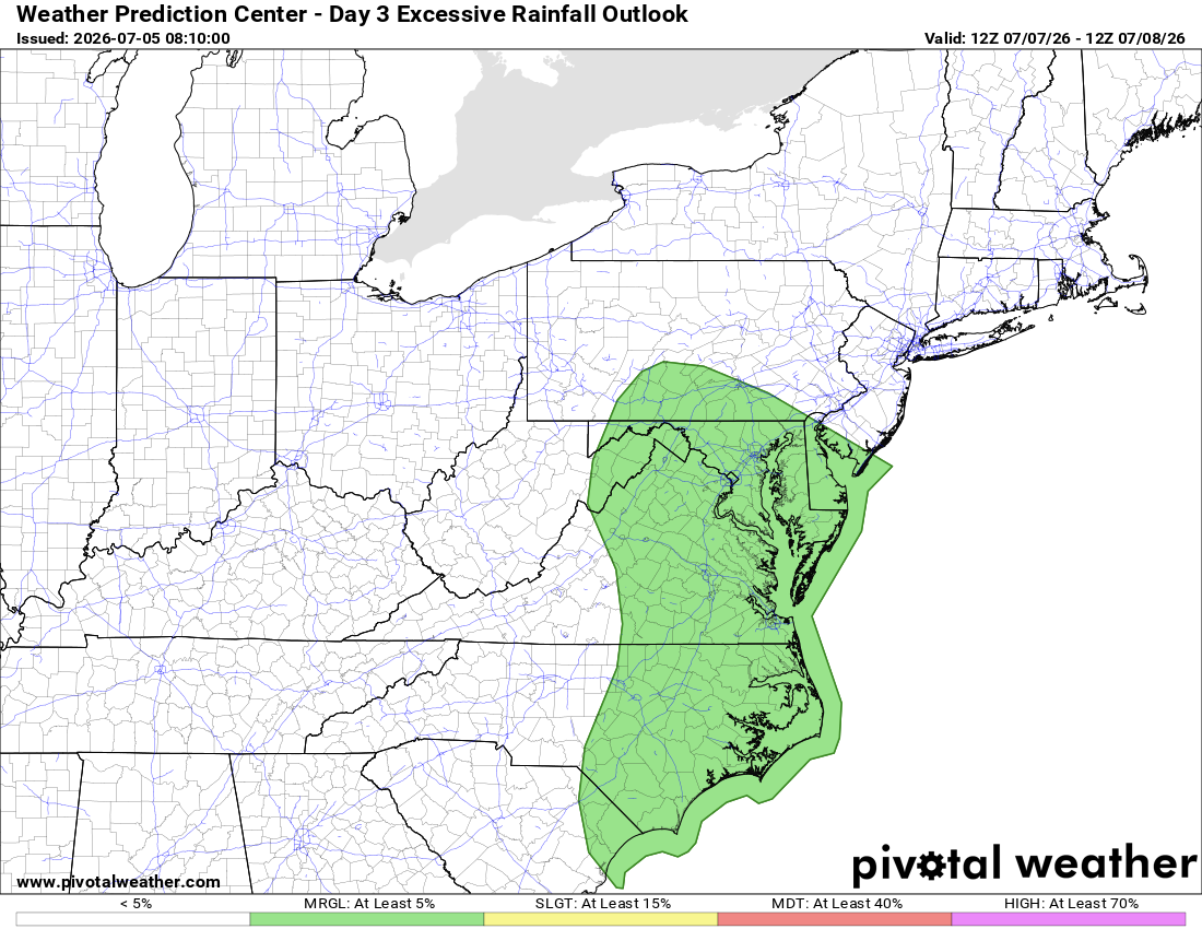
As part of the package, dew points by Tuesday may be closer to 70 degrees (muggy) rather than 75 (oppressive). Small victories!


![Q&A: Flood watch until 1am. Less hot, still humid this week. Watching storms [Sundays@7 Live Chat]](https://storage.ghost.io/c/9b/2a/9b2aed80-72a3-473a-aaf8-035d8a6ee8cb/content/images/size/w960/format/webp/2026/07/Screenshot-2026-07-05-at-18.49.22.png)


