



A strong cold front will approach and move through the area on Tuesday, triggering rounds of showers and thunderstorms. Some storms during the afternoon and evening could be severe.
A few showers and even a rumble of thunder may first develop in the morning, roughly between 5 and 9 a.m. Then there could be a lull from mid-morning into early afternoon before additional showers and thunderstorms develop between about 2 and 9 p.m. The period from roughly 3 to 6 p.m. may be especially active.
The National Weather Service has placed the area in a Level 2 out of 5 risk for severe storms. In addition to heavy rain and frequent lightning, the primary threat is damaging wind gusts. A few instances of large hail and perhaps a brief, isolated tornado are also possible, especially south of DC toward Virginia's Northern Neck, Southern Maryland and the southern Delmarva Peninsula.
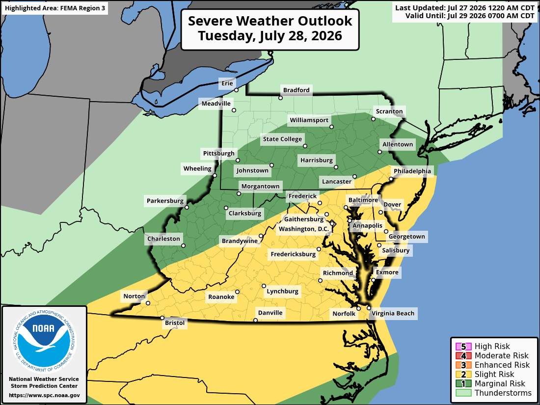
The risk of severe weather may be somewhat greater south of DC, where greater heat and humidity could provide more fuel for storms. Around the Beltway and farther north, morning clouds may limit that instability. However, if the sun breaks out for a few hours during the day, the potential for severe storms would increase.
Storms should move quickly enough to limit the risk of widespread flooding. Still, some could produce torrential downpours and isolated flooding near streams and in poor-drainage areas, especially where multiple storms track over the same locations.
We'll continue to refine the forecast and provide updates on the storm threat throughout Tuesday.


