




A warm front is surging north through the area, increasing heat and humidity and setting the stage for scattered strong to severe storms this afternoon and evening.
The most probable timing for storms is between 2 and 7 p.m., from west to east. In the Beltway area, they're most likely between 3 and 6 p.m.
The increasingly steamy air will provide fuel for storms while a disturbance in the high-altitude flow acts as a possible trigger. The National Weather Service has placed the area under a Level 3 out of 5 "enhanced" risk for severe storms.
Because of the high humidity and the potential for storms to produce very heavy rain in a short amount of time, the Weather Service has also issued a flood watch from 2 to 8 p.m.
"Localized rainfall rates of up to 2 inches per hour, with isolated totals of 2 to 4 inches are possible," the agency wrote.
In addition to torrential rain and lightning, storms may also produce damaging wind gusts of up to 60 to 70 mph, a few instances of hail and perhaps an isolated, short-lived tornado.
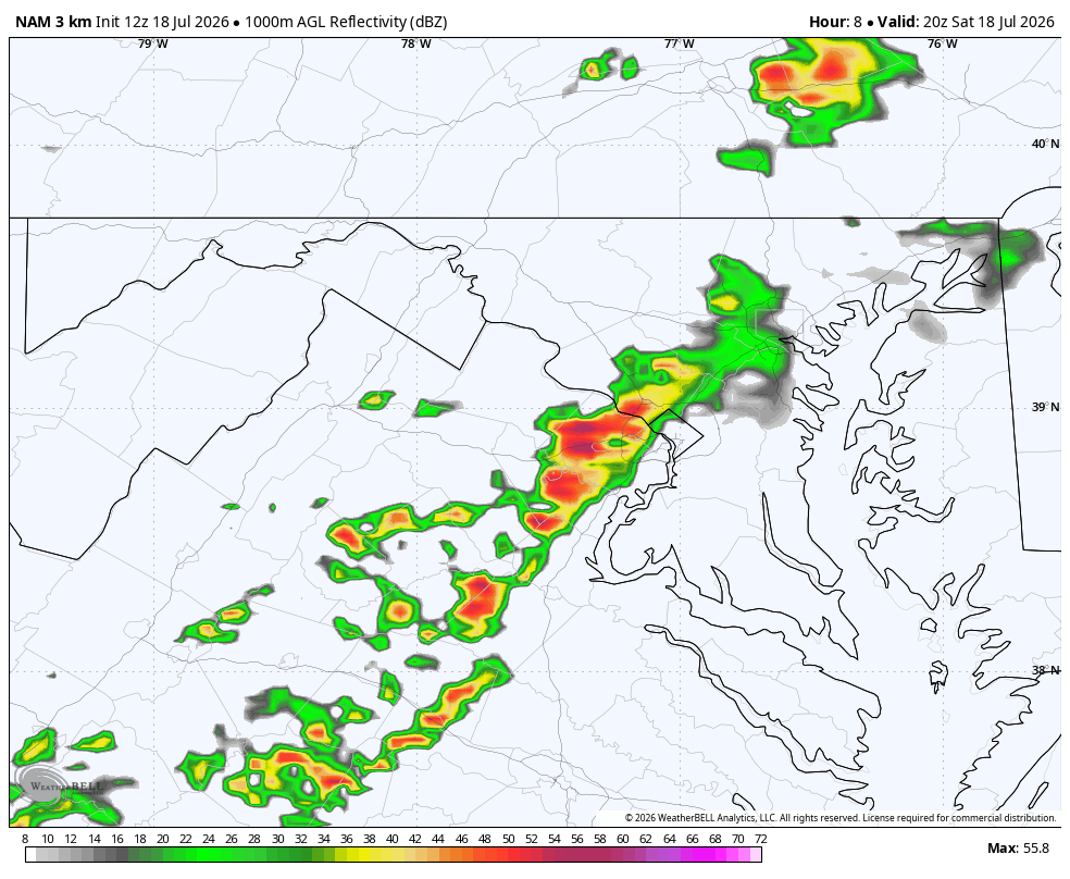
Short-term models conflict as to whether storms will be more hit or miss or widespread.
It's possible the additional showers and storms pass through late in the evening and overnight after the initial round, but they probably won't be severe.
It's reasonably likely that the Weather Service will issue a severe thunderstorm thunderstorm watch.
We'll post updates if severe weather develops in the area.
Will the smoke affect the storms?
The code red air quality over the area Saturday morning, because of the smoke pollution, mean a moderate concentrations of smoke particles were present in the lower atmosphere. The manner in which this smoke changes the storm environment, and/or the character of the storms themselves, poses an interesting question.
Dense smoke does reduce the intensity of sunlight reaching the ground, which can diminish the degree to which the atmosphere destabilizes and is thus able to trigger thunderstorms.
For storms that manage to form, there is some research suggesting that smoke particles alter the cloud microphysics (the microscopic formation of rain and ice) in such a manner that lightning generation can be intensified. It’s likely, however, with enough of a south wind this afternoon, some of the remaining smoke gets scoured out and smoke concentrations fall into the code orange range.


![Q&A: Decent Monday with less smoke. Humid Tuesday with severe storms possible [Sundays@7 Live Chat]](https://storage.ghost.io/c/9b/2a/9b2aed80-72a3-473a-aaf8-035d8a6ee8cb/content/images/size/w960/format/webp/2026/07/Screenshot-2026-07-19-at-18.39.44.png)

