



A strong cold front with a history of producing severe weather will plow through the DC area late today, triggering numerous showers and thunderstorms. The severity of the storms in our area may depend on how much sunshine we see today.
The greatest chance for storms is between 3 and 8 p.m., although a few scattered showers could pass through before or after. Around the Beltway, the strongest storms are most likely between about 5 and 7 p.m.
Heavy rain and frequent lightning are expected with any storms that develop, and there is a slight risk of damaging wind gusts and hail. The National Weather Service has placed the area under a Level 2 out of 5 risk for severe storms. An isolated, brief tornado cannot be ruled out, especially southeast of the Beltway toward Southern Maryland and the southern Delmarva.
NWS storm risk Tuesday
Sources: SPC/NWS, OpenStreetMap/CARTO.SPC/NWS · OSM/CARTO
If the sun breaks out this afternoon, it would boost temperatures and instability, increasing the potential for stronger storms. On the other hand, considerable cloud cover and scattered showers ahead of the main line could limit that instability.
The position of a warm front moving through the region may also influence storm intensity. If it lifts north of DC more quickly, it would allow greater heat and humidity to build, further increasing the severe weather threat.
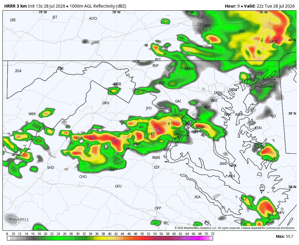
The showers and storms should move through relatively quickly — probably lasting no more than an hour at most locations — limiting the risk of widespread flooding. However, rainfall rates could be intense, leading to isolated, short-lived flooding in poor-drainage areas.
The flood risk is somewhat higher northeast of the Beltway, especially from Annapolis northward, where a flood watch is in effect. There, storms may be more numerous and linger longer.
The Weather Service may issue a severe thunderstorm watch for the region, and we'll post updates if severe weather develops.


