



You might have noticed dimmed sunshine today, despite minimal cloud cover. There's also a bit of an orange tinge to the sky, especially noticeable this morning and probably again toward sunset.
Yep, the wildfire smoke is back. The origin is different this go.
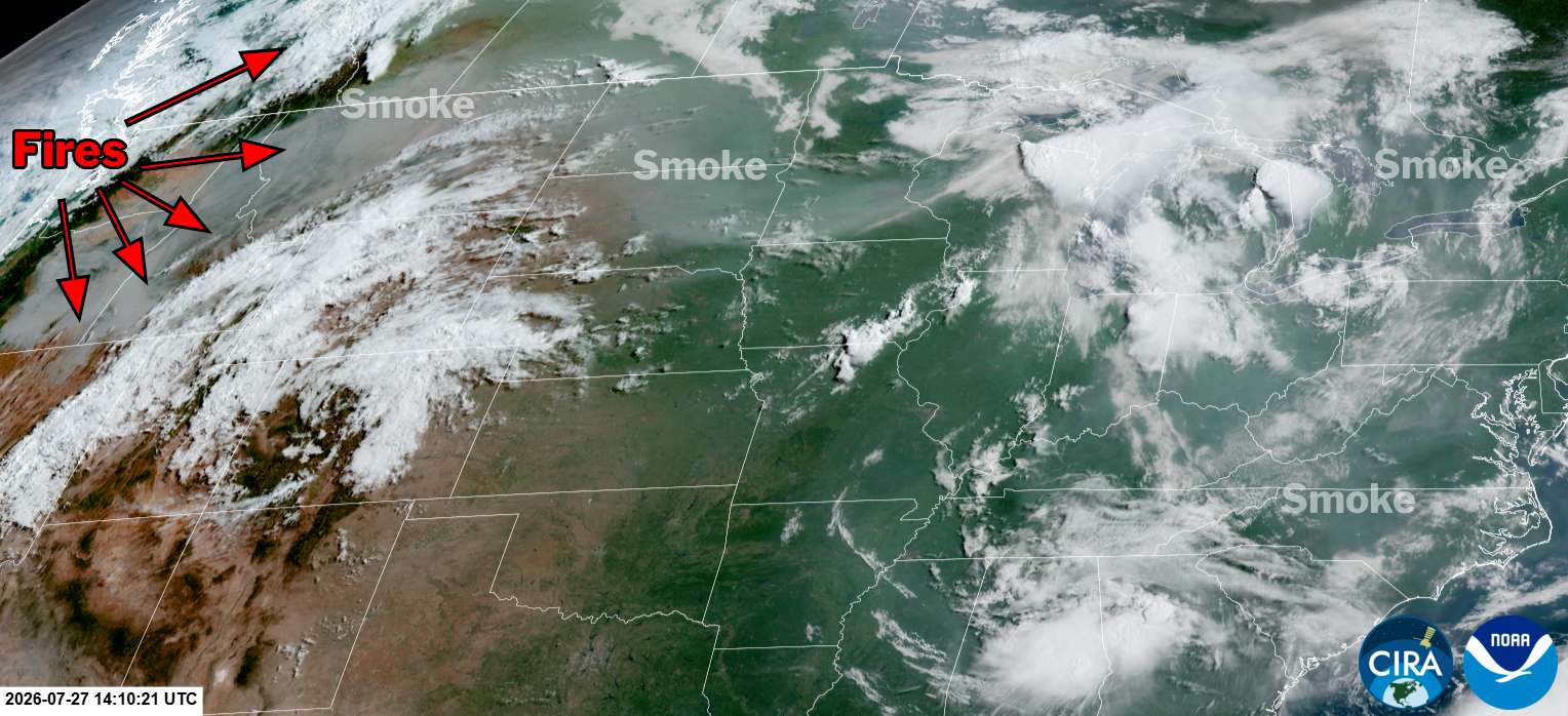
For the most part, this bout of smoke is coming from the Pacific Northwest into western Canada, where massive fires are burning, particularly in Oregon and British Columbia. In similar fashion to the smoke outbreak from Ontario fires July 17-18, the plume is riding atop strong high pressure currently centered from the Rockies to the southern and central Plains.
Partly because the origin is further away, air quality concerns at the ground are much lower than 10 days ago. It is unlikely to get considerably worse than the current "moderate" code yellow Air Quality Index values in and around DC today. Unhealthy air is largely confined mostly to Montana and westward.
Ocean City this morning. pic.twitter.com/pSCO79h3P1
— EdWiz (@edwizzz) July 27, 2026
We'll continue to see the mainly thin veil of upper-level smoke through the rest of today and probably tonight. It'll clear out a bit with the storm threat Tuesday, then might return right behind the front on Wednesday before shifting south with that.


