



The smoke gradually improves Saturday but then we have a risk of scattered strong to severe storms to deal with later in the day, mainly between 2 and 8 p.m.
Several ingredients are expected to be in place Saturday that could turn some storms severe with the potential for damaging winds, hail, and a tornado. Those ingredients include warm afternoon highs in the upper 80s to mid-90s, very high humidity with dew points in the mid-70s, and a nearby front.
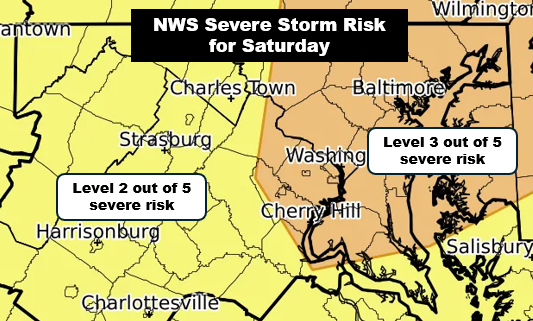
The National Weather Service has placed much of the DC area under a Level 3 out of 5 severe storm risk for Saturday.
There is a wildcard — the smoke. While there’s less of it than today, there could be enough to keep temperatures a couple of degrees cooler than they would otherwise be, which could lead to storms that aren’t as numerous and intense as some models anticipate.
Another round of storms is possible later Saturday night, perhaps after midnight, although those storms may weaken as they approach from the northwest.


