



Very humid air remains parked over the DC region while a slow-moving front meanders nearby. Together, they're expected to spark late-day and evening showers and thunderstorms for a fourth straight day.
Because the front is positioned south and west of DC, that's where showers and storms are expected to be most numerous. The National Weather Service has issued a flood watch for areas well west and southwest of the city, where rainfall rates could reach 2 to 3 inches per hour in the strongest storms this afternoon and evening.
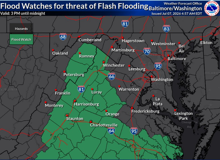
But computer models also suggest storms may develop north of the front, although they should be less numerous and generally less intense. Around the Beltway, the best chance for rain is between about 7 p.m. and midnight. Farther north, rainfall is less likely, but a brief downpour can't be ruled out.
How much rain fell last night?
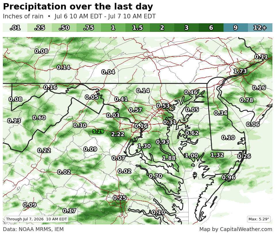
Numerous showers and thunderstorms erupted Monday evening along the same front. The heaviest rain, by far, fell in a west-to-east corridor from just north of Warrenton to Dale City. Rainfall totals of 1 to 4 inches were widespread, with isolated amounts topping 5 inches in northern Fauquier County, just south of Interstate 66.
DC-area storm event summary for July 6-7
| Time | Value | Location | Notes |
|---|
Several reports of flooding came from this corridor, including a swift-water rescue near Nokesville.
Pockets of heavy rain also developed farther north, including eastern Loudoun County and parts of western and central Montgomery County, where 1 to 3 inches fell.
The Beltway area keeps getting missed
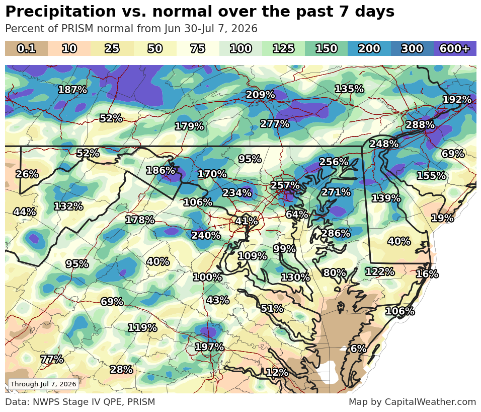
The Beltway area has been threading the needle. While communities surrounding DC have repeatedly been soaked with 1 to 3 inches of rain, most locations inside the Beltway have received less than half that amount over the past week.


