



If you've ever noticed that urban areas stay noticeably hotter than the surrounding countryside, you've experienced the urban heat island effect. Dense concentrations of concrete, asphalt and buildings absorb and retain heat, causing temperatures in urban neighborhoods to run several degrees higher than in nearby rural areas.
During hot weather, urban neighborhoods can easily be 5 to 10 degrees — and sometimes even more — warmer than surrounding rural areas. That not only makes cities less comfortable during heat waves, but also increases the risk of heat-related illness while driving up demand for air conditioning and energy costs.
To better understand the urban heat island in Fairfax County, Arlington and the City of Alexandria and identify ways to reduce impacts, the Faith Alliance for Climate Solutions and George Mason University's Virginia Climate Center are partnering on a new initiative called the Urban Heat Island Mapping Project.
Thirty teams of volunteers will collect data that will be "analyzed and rendered into maps and visualizations designed to inform urban planning decisions, support public health interventions, and advance environmental equity," the alliance wrote in an email to members.
The alliance is seeking volunteers to help collect heat data on the measurement day, which is expected to occur between July 8 and 24. If you're interested in participating, complete the Urban Heat Island Mapping Project Volunteer Sign Up form.
Volunteers can serve as drivers, collect temperature measurements or assist with logistics, and all participants will receive training beforehand.
"This is an exciting project with important local policy and public health implications," the alliance wrote. "The results of the study will be released in the fall of 2026 and will be used to inform policymakers about targeted actions, especially those that prioritize benefits to disadvantaged communities, who disproportionately bear the health and economic burdens of extreme urban heat."
Similar urban heat island mapping projects have been conducted across the country and have helped guide efforts to plant more trees, build shade structures, install cool roofs and better prepare vulnerable communities for extreme heat.
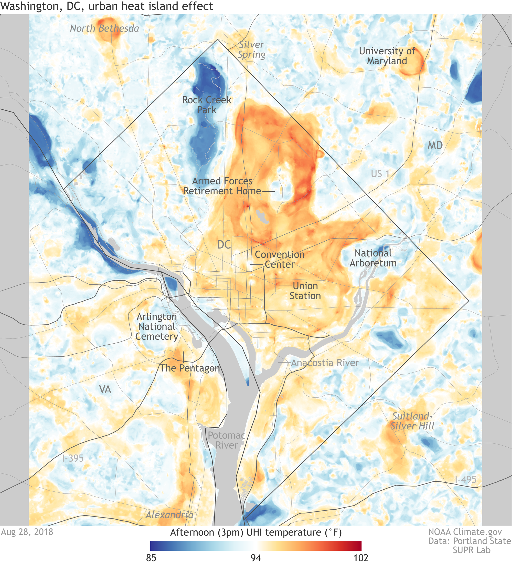
A similar project held in DC in 2018 showed that some neighborhoods were up to 17 degrees hotter than nearby areas on a hot August day.


