



The District will miss 90 Tuesday, after a six-day streak of readings that high or higher. It was the longest heat wave of the season so far.
Included in that streak were record highs of 102, 102, and 103 from July 2 to 4. Tied for the hottest July 1 to 6 in DC records with 2012, the average temperature of 88.2 degrees was 7.7 degrees above average.
As of today, we're currently tied for fourth-most 90-degree days to date. Only three years have seen more 90s and 100s through now: 2010 and 1991, with 27, then 1994, with 26. In that group, 2010 tied for the second-most on record for a year, with 67 such days.
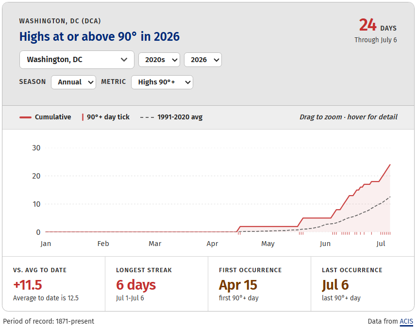
While DC is at the extreme for 90-degree days locally, everyone around here is running above average to date. Dulles Airport's 15 is five above average, Baltimore's 20 is nine days above typical, and the 11 days in Damascus, Maryland, is 7 above average there.
Outside occasional instances, like today and tomorrow, temperatures are forecast to remain near or above 90 in DC ahead. That's common for the time of year, given that 90 is the average high from July 6 to 27.
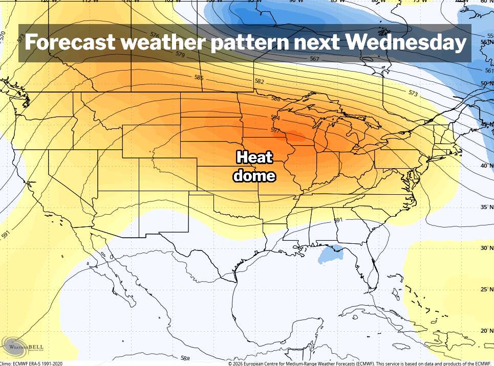
While there are no more 100s in our immediate future, a massive heat dome developing in the Rockies this weekend will shift into the central Lower 48, and perhaps toward the Great Lakes, through midmonth. That's a pattern that would probably support at least somewhat above-average temperatures around here.
The National Blend of Models, a system that uses an average of a bevy of computer outlooks, shows a string of 90s to mid-90s making a return next week. The National Weather Service has us with relatively high odds of above average temperatures, too.


