




A flood watch is in effect through this evening in the area highlighted above. A gusty storm and a few heavy downpours remain possible.
6:00 p.m. update
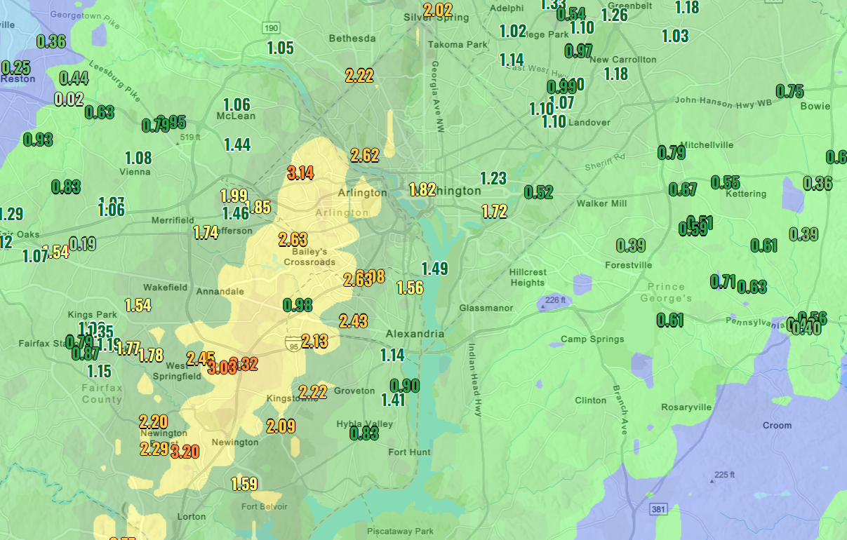
A zone from Newington to Arlington and into western DC has repeatedly been slammed by heavy showers and storms today. Numerous locations have seen 2 to 3-plus inches.
The rain is causing some flooding, especially around Fairfax where several reports of roads underwater have come in.
With 1.49 inches in DC and more probably on the way, today may try for wettest day of the year, a spot held by the 'Snowcrete' storm in January.
From earlier...
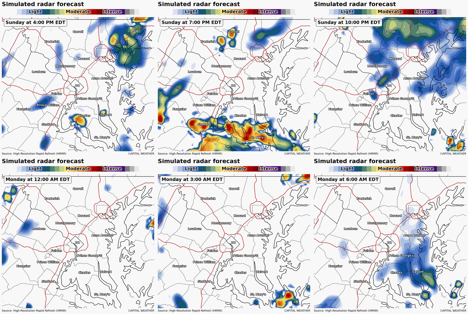
Into tonight, some flooding risk around town but it’s a bit higher along the I-81 corridor.
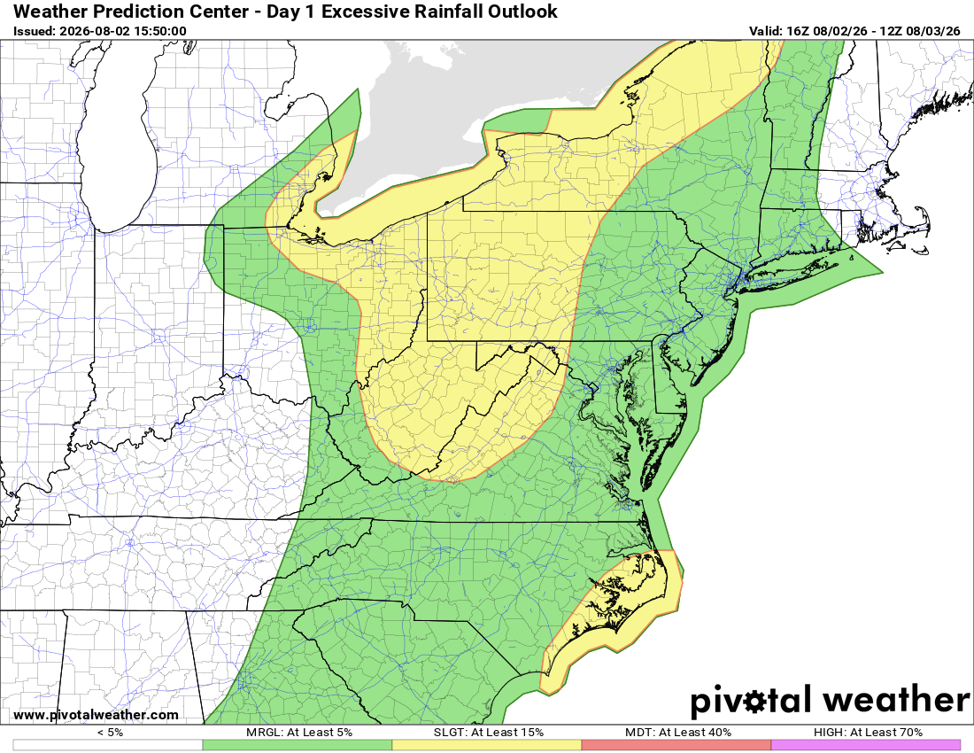
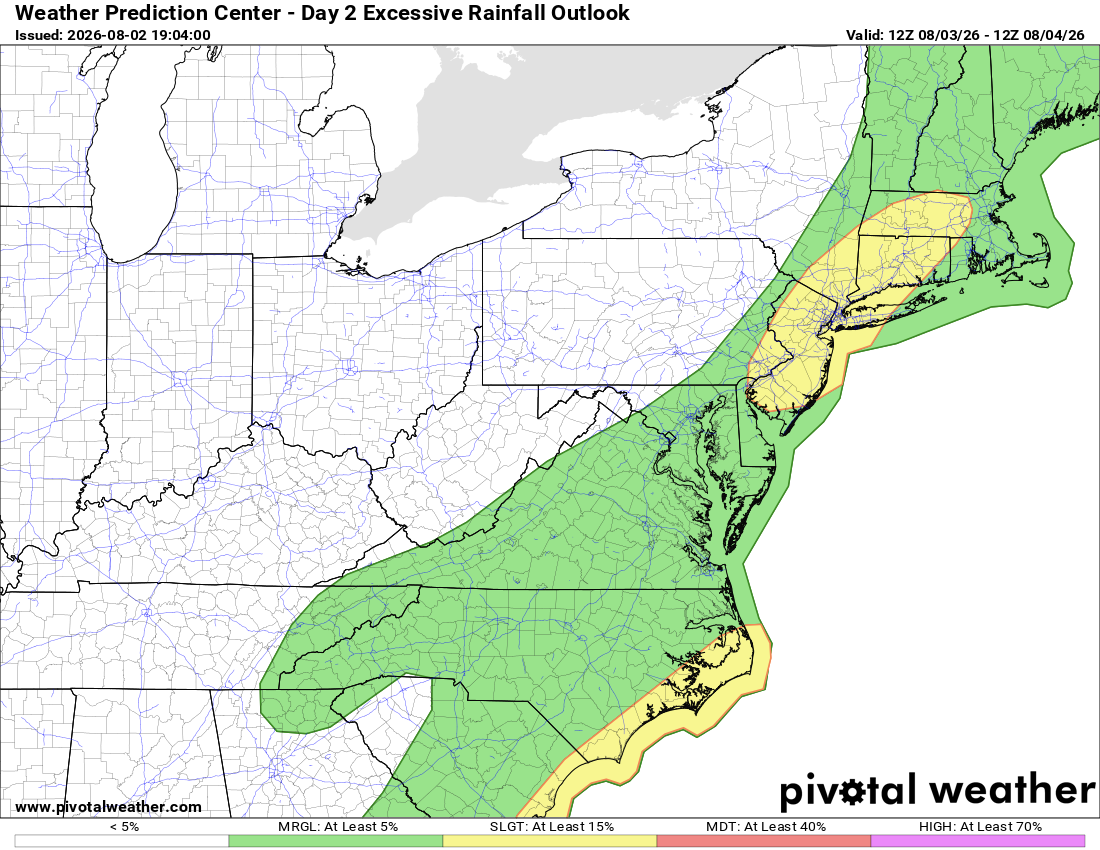
Rainfall intensity is expected to wane Monday, with a marginal chance for heavy downpours. A couple of reports of flooding can't be ruled out.
A secondary, marginal threat through tonight is one or two damaging wind gusts over 57 mph. Our severe storms expert, Jeffrey Halverson, notes: "If there is any wind it will be an isolated microburst from water loading" — a reference to the atmosphere's exceptionally high moisture levels right now.
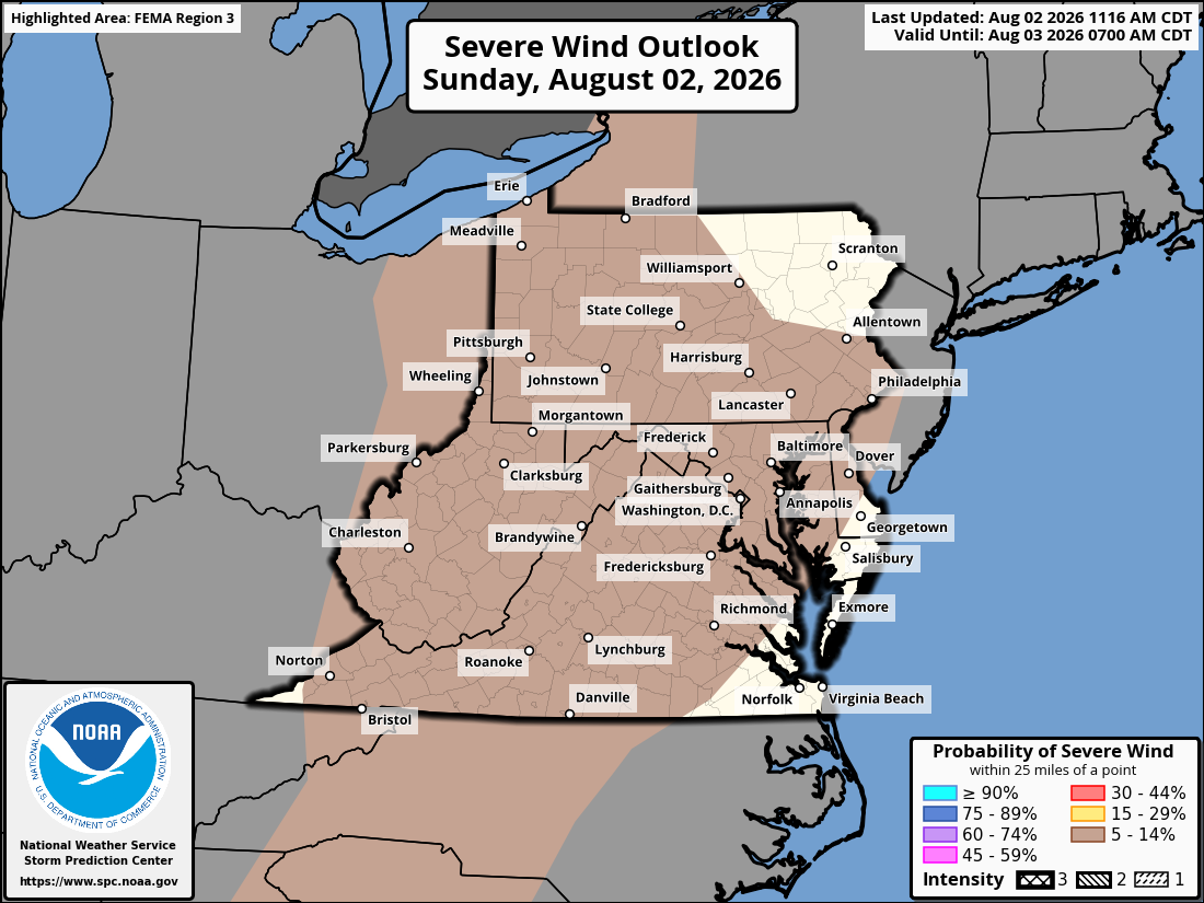
Should any storm decay quickly, all its moisture could be unleashed at once over one location. This thinking is what led to the flood watch being issued.
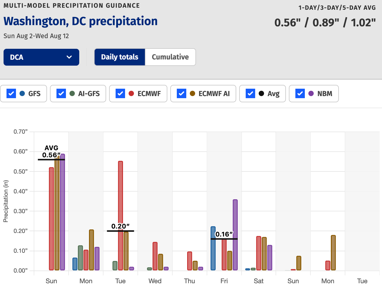
As for tomorrow, rainfall projections have come down and the severe storm threat appears to be minimal even if we do see a couple of heavy downpours. We'll keep an eye on near-daily storm chances this week.


