



It's worth staying slightly weather-aware the next couple days as storm and downpour chances increase. We will see rain but how much remains a bit uncertain. Weather models disagree.
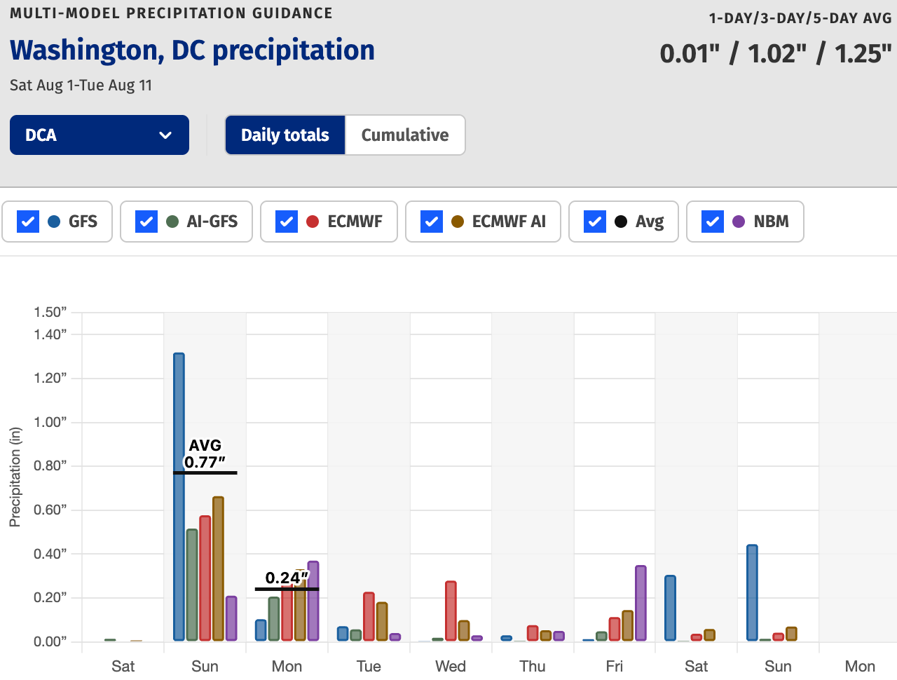
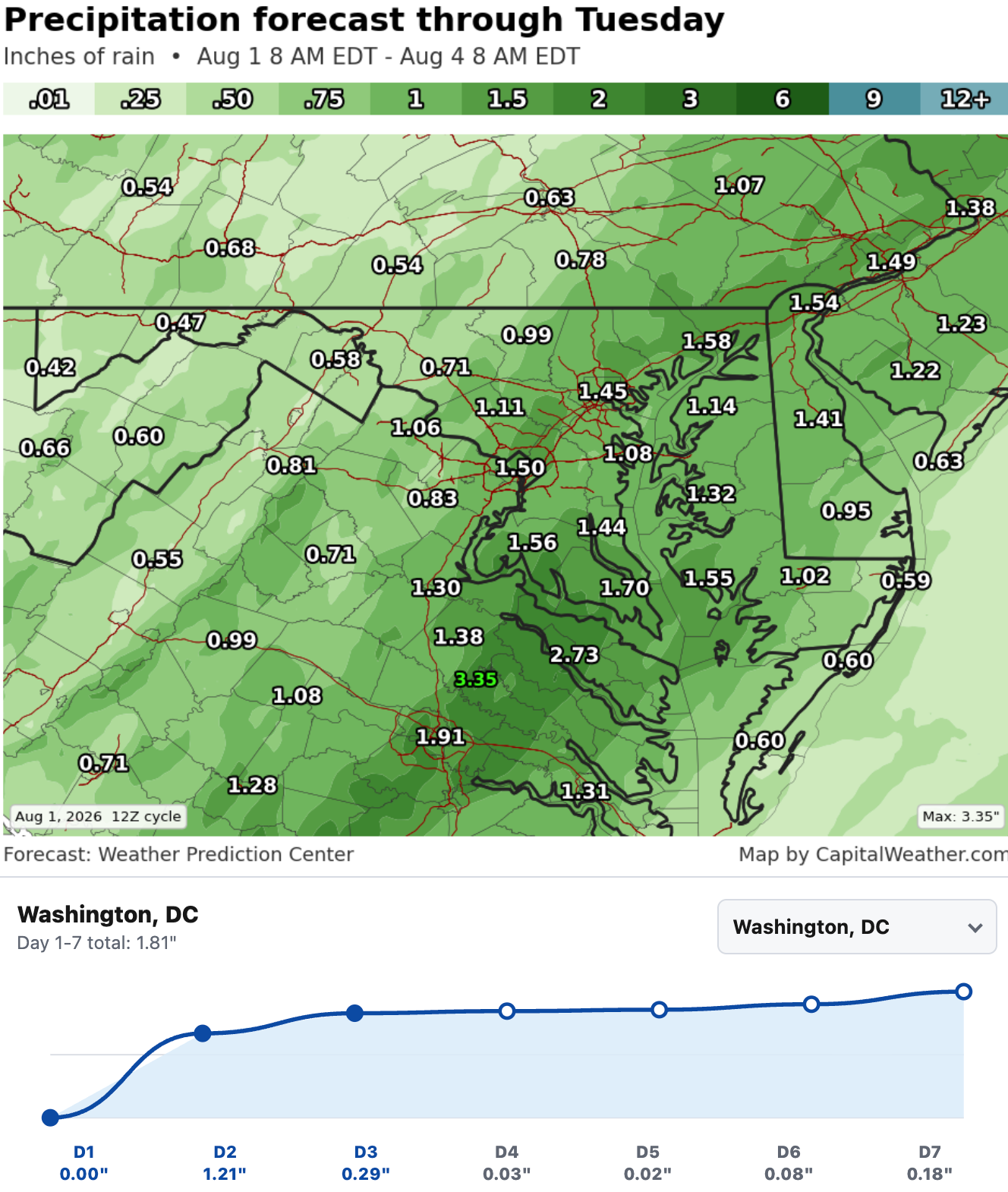
We may see a patchwork of rain amounts in the region but most of the upcoming week's rain is expected to fall by early Tuesday.
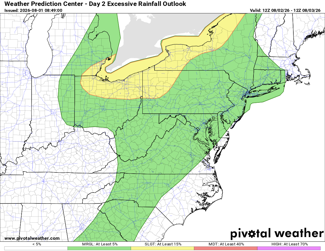
Downpours are marginally possible tomorrow (see below) and even a couple gusty storms (featured image at top) but neither risk looks widespread.
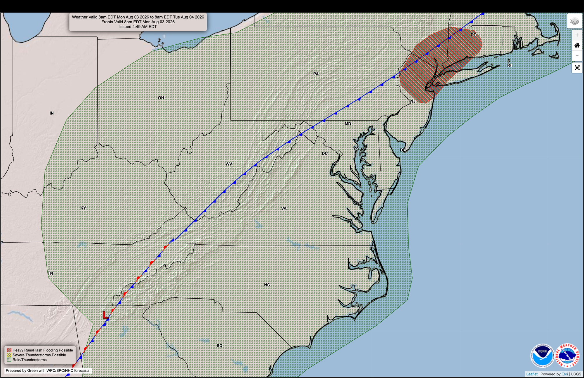
Some pockets of heavy rain are possible even into Monday with anywhere from around a half inch to one inch of rain looking like a reasonable initial estimate for much of the region through Monday night.
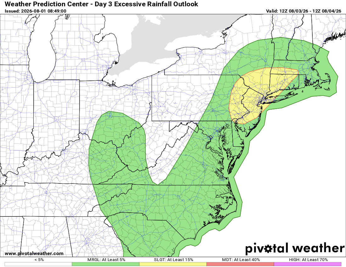
While localized spots could easily see more or less, depending on how training storms line up, we want to highlight these risks despite medium forecast confidence. Monday has mixed severe storm signals as well.
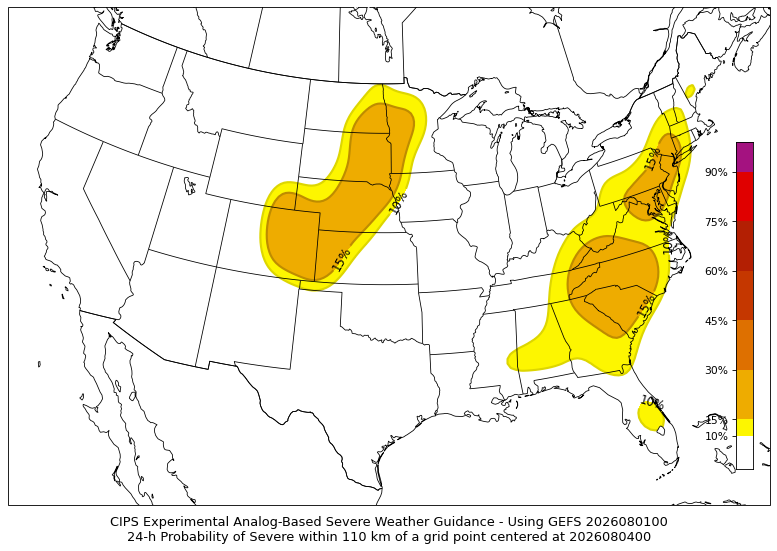
Severe potential, while trickier to pin down, has an additional ingredient Monday favoring stronger storm development: a cold front moving in from the northwest.
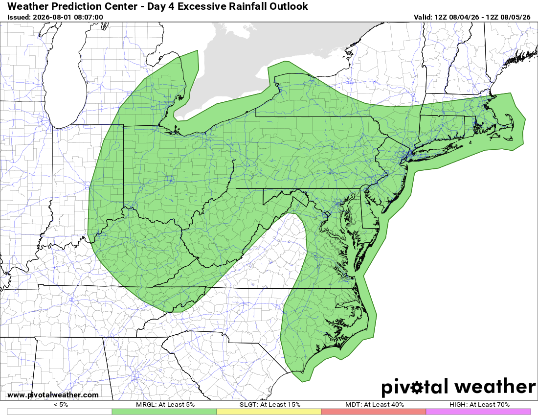
Even into Tuesday, the marginal chance for intense downpours doesn't fully disappear, as atmospheric moisture is slow to decrease behind Monday night's front.
To reiterate, neither Sunday nor Monday looks to have a particularly high chance of strong winds or hail, but in summertime, an isolated storm going severe is always possible. Beyond that, the main story is locally heavy rain with plenty of tropical moisture in place, plus frequent lightning.


