


Significant heat is expected starting Thursday, especially for urban locations and near the Bay. It could feel as steamy as 100-105º.
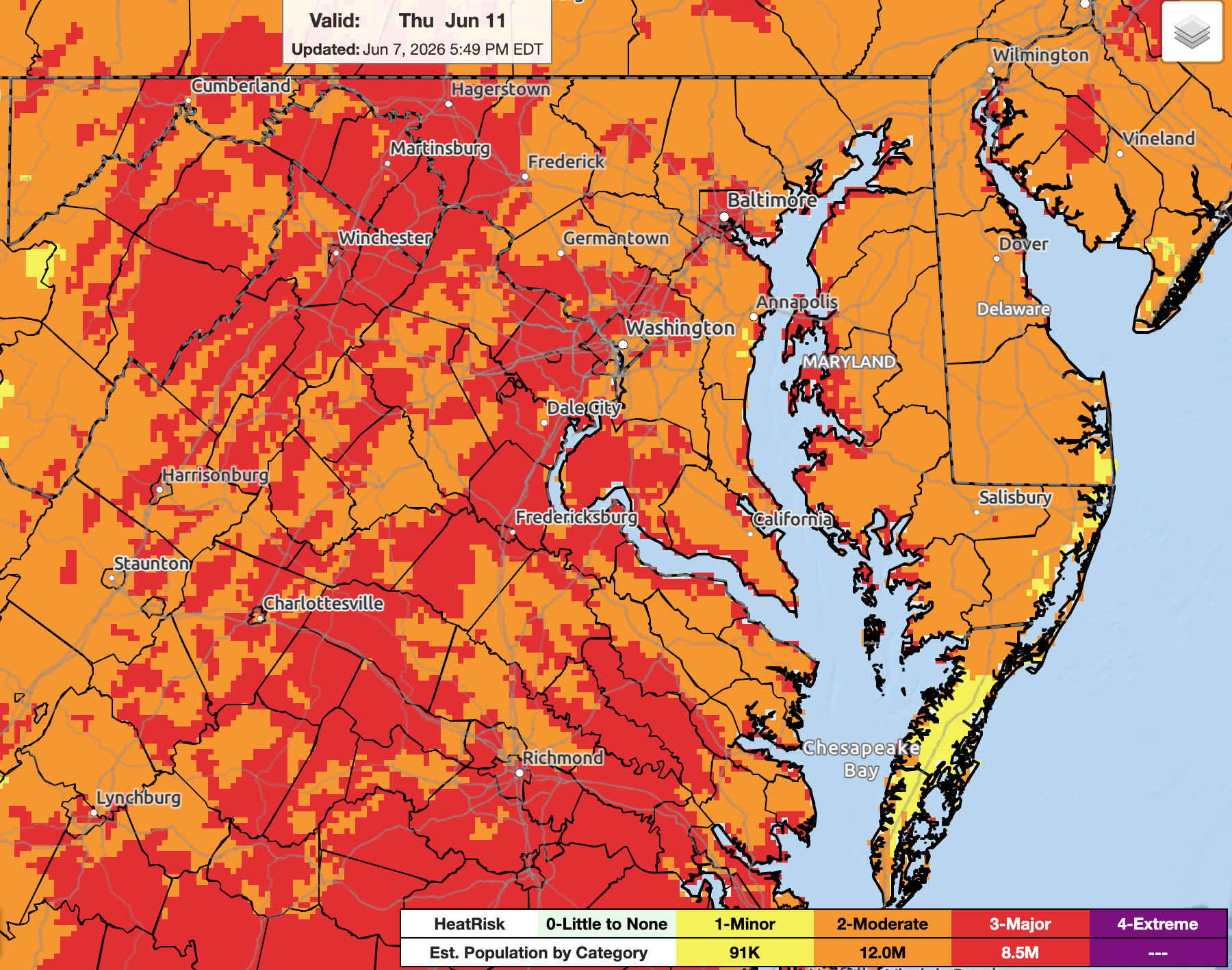
Thursday is the first day weather models start indicating that hot air temperatures in the 90s combine with high humidity (dew points around 70º) to produce heat index values around or over 100º.
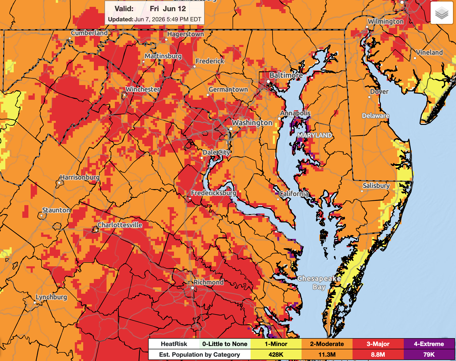
Friday may be worse. A few locations near the Bay — where it could be extra muggy — may see top-tier heat risk with an estimated 79,000 people impacted.
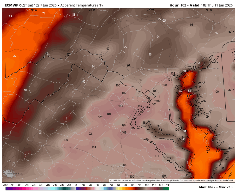
In the leading image at top, you can see the Euro model suggests 105º heat indices are slightly possible Friday. 105º is about the threshold at which this scale tips into "extreme" level-4 (magenta colored) readings since the body cannot cool itself naturally by evaporating sweat.
Please plan to hydrate and take frequent breaks from the sun — and stay tuned to our forecast as we get closer.


![Q&A: Decent Monday with less smoke. Humid Tuesday with severe storms possible [Sundays@7 Live Chat]](https://storage.ghost.io/c/9b/2a/9b2aed80-72a3-473a-aaf8-035d8a6ee8cb/content/images/size/w960/format/webp/2026/07/Screenshot-2026-07-19-at-18.39.44.png)


