


While a little stickier than the last two days, today marks the third pretty nice day in a row. Highs in the mid- to upper 80s and moderate humidity are standard fare for the second half of June.
But, tomorrow, yuck.
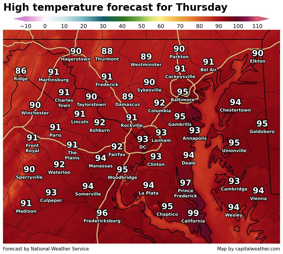
Temperatures surge into the 90s and uncomfortable levels of humidity return as dew points climb to near 70.
And the heat and humidity may fuel some strong to severe storms in the region.
The severe storm threat is somewhat uncertain, though, because morning clouds and possible showers may steal fuel from potential storms later in the day. There may be more fuel available ot the south, toward Southern Maryland and Virginia's Northern Neck, where highs are predicted to reach the mid- to upper 90s.
Additionally, it's unclear how widespread storms will be because the strongest wind energy with the approaching front will be north of the area.
In short, the D.C. area will have access to some storm fuel and some wind energy, but those quantities will be stronger to the south and north, respectively.
The National Weather Service Storm Prediction Center has placed the area in a Level 2 out of 5 risk zone for severe storms. The hazard of most concern is potentially damaging wind gusts, in addition to heavy rain and lightning.
While subject to change, the most likely timing for storms is between 3 and 9 p.m.
We'll have new updates on the storm threat tomorrow.


