



It's another blissful day as we close out May. Plenty of sunshine and highs in the 70s.
The niceness will not last as June gets going.
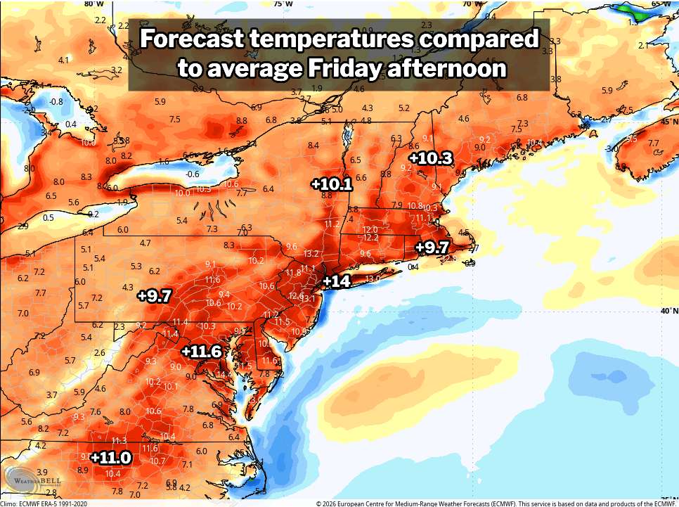
Weather modeling is quite suggestive of 90 or above for at least a couple days starting around Friday – the map shown here has widespread highs 10 degrees or more above normal. Our seasonal average is about low 80s late in the week. Warmer than normal readings also look to last beyond the pulse of higher heat.
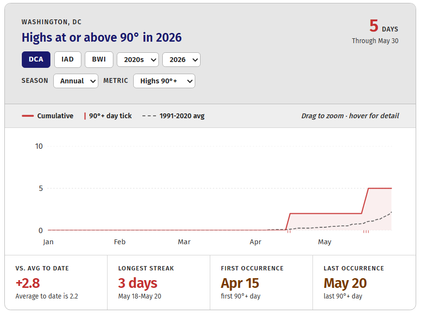
We're still running above average for 90-degree days, as seen in one of our super fun interactive data displays in the Climate Room.
DC is about to hit prime time for 90-degree days, averaging seven in June as climatological summer gets underway. On and around the start of June, Washington averages one 90-degree day about every four days. At peak in mid-July, it's one new 90-plus every one to two days.
As such, DC and nearby hotspots will see the tally of 90-degree days climb a good deal in the weeks ahead.
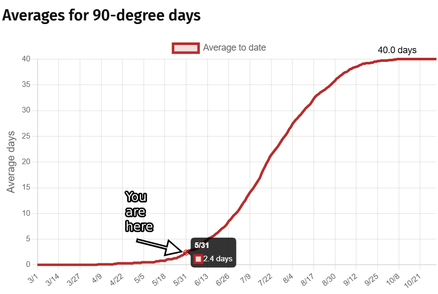
The daily average high in DC hovers at 90 degrees from July 6–27. A typical full warm season sees 40 days at or above the mark.


