

The situation: Showers and storms moved through the DC region this evening, causing some damage in the area of Burke and Fairfax. The main severe storm threat moved east of the Chesapeake Bay.
8:10 p.m.: As the storms continue advancing eastward, they have triggered numerous severe thunderstorm warnings and a few tornado warnings across the Maryland and Delaware Eastern Shore, including a tornado warning near Cambridge. Strong to severe storms should reach the Maryland and Delaware beaches by around 9 to 9:30 p.m.
7:15 pm: The most intense storms are now in Calvert and St. Mary's counties and moving east. Rain is light and ending over western parts of the area. The end of the main round will work east across the rest of the area over the next hour or so.
Fairly significant damage occurred in and around Burke and Fairfax, as shown in part below.
Some additional – probably more isolated – showers and storms are possible until the front passes around midnight.
6:34 pm: An additional tornado warning has been issued for parts of Charles County, including Pomfret and Waldorf, until 6:45 pm.
While we can't confirm a tornado as in the report below, some significant tree damage is seen from earlier storms passing Fairfax.
@capitalweather.com my neighborhood in Fairfax is completely destroyed. Almost all of the trees are down. Multiple neighbors spotted a tornado.
— Mara Surridge (@marasurridge.bsky.social) June 22, 2026 at 6:03 PM
[image or embed]
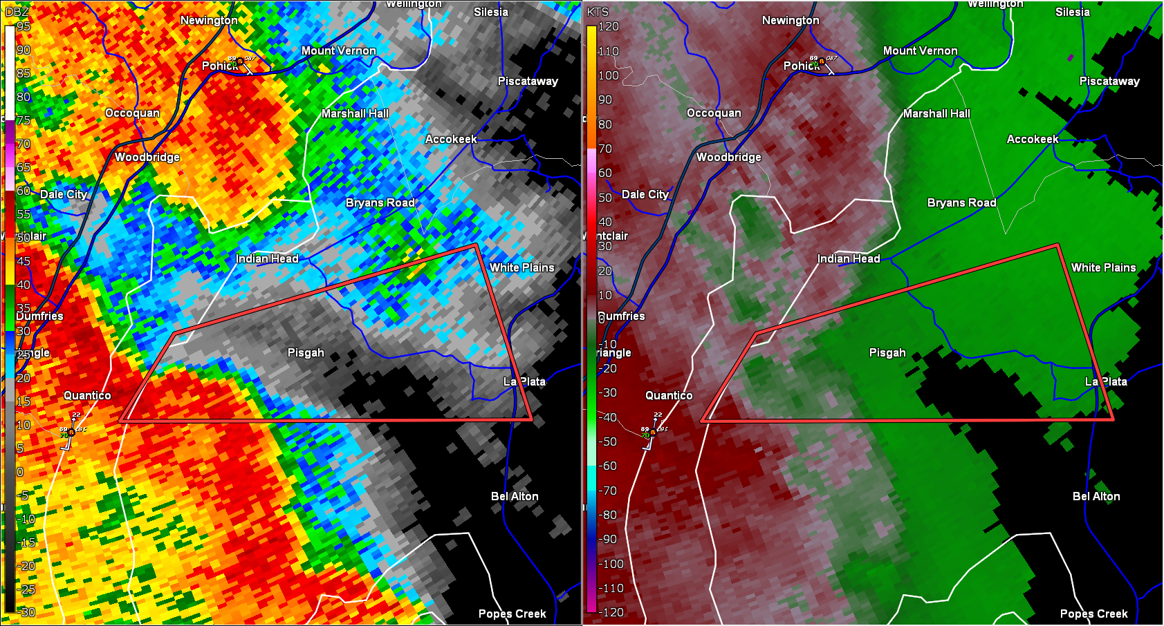
6:22 pm: Tornado WARNING for parts of Charles County until 6:30 pm
Storm capable of tornado was east of Quantico and moving east. Includes Pisgah, Pomfret, and La Plata in Maryland.
(only the active tornado warning shown to highlight area)
5:50 pm: Severe thunderstorm warning until 6:15 p.m. for parts of DC and PG County. Another warning was also recently issued for southwestern suburbs.
We've seen a gust of at least 56 mph at National Airport from the storm passing the immediate area, in addition to trees down near Burke and many reports of hail in the core.
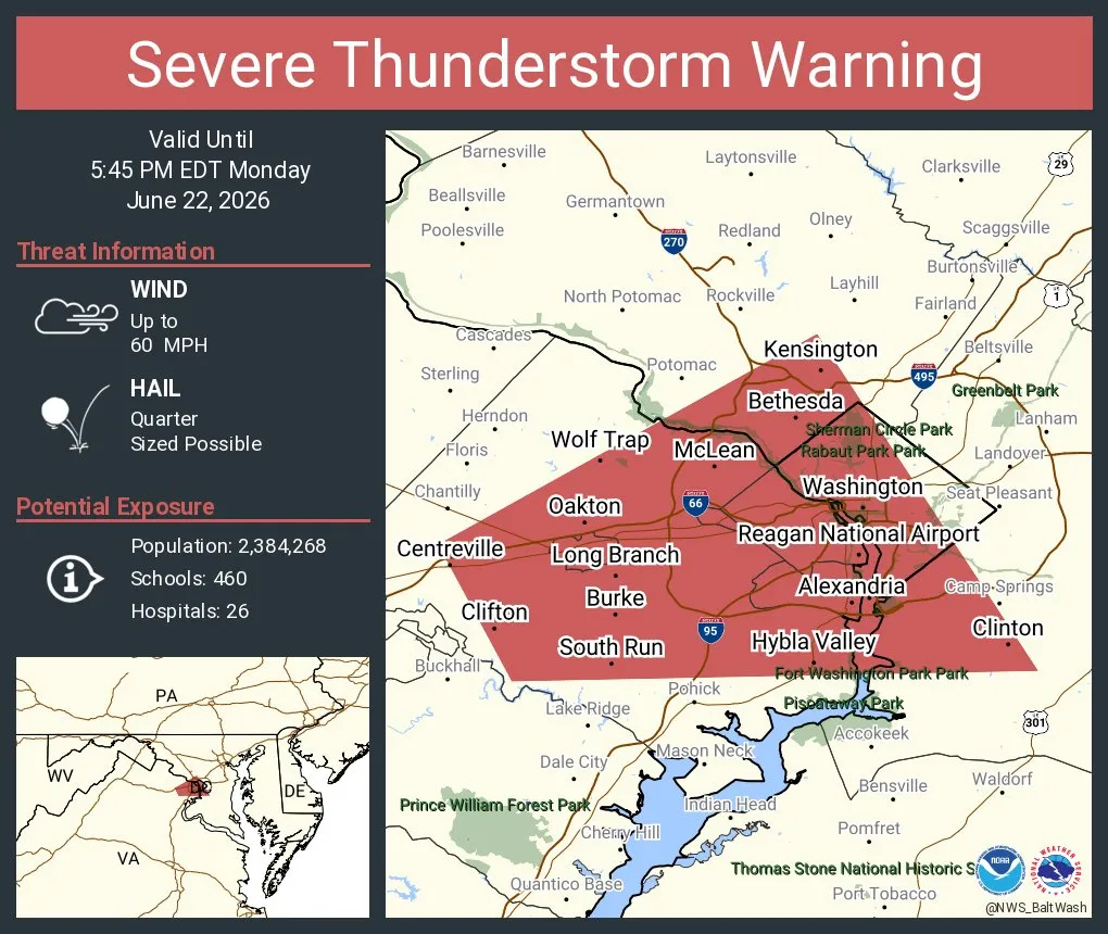
5:10 p.m.: Much of DC and the western Beltway area are under a severe storm warning until 545 p.m. An intense storm is centered over Fairfax to West Springfield and moving east.
This storm has the potential for 60 mph wind gust and 1 inch hail.
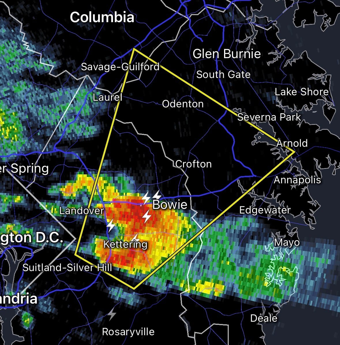
4:50 p.m.: A severe thunderstorm warning has been issued for northeast Prince George's and northwest Anne Arundel counties until 5:15 p.m. Damaging 60 mph wind gusts and quarter-size hail are possible with this storm. The warning includes Bowie, Crofton, and Odenton.
4:10 p.m.: Scattered showers and a couple of thunderstorms are now popping up around the immediate DC area, including a heavy downpour with lightning and gusty winds near Alexandria moving north into southern and eastern parts of DC and central Prince George's County. So far nothing considered severe except for a storm with strong winds and hail moving east into southwest Fauquier County.
3:10 p.m.: Some showers and storms have developed to the west along I-81 near Luray, Front Royal, and Winchester. We'll watch this area as it advances to the east.
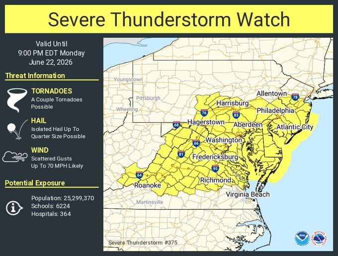
2:15 p.m.: The National Weather Service has issued a severe thunderstorm watch for the entire DC region until 9 p.m. The Weather Service identifies the primary threats from any severe storms that develop as scattered damaging wind gusts to 70 mph, isolated large hail to 1 inch in diameter, and a tornado or two.
Remember that a severe thunderstorm watch means conditions are favorable for severe storms, but not a guarantee. Stay alert. If a severe thunderstorm warning is issued for your location, it means a severe storm is imminent and you should seek shelter immediately.