


You can feel today's increasing humidity, and the juicier atmosphere could help fuel some intense thunderstorms this afternoon and evening.
The most likely timing for storms is between 3 and 8 p.m. across the region and between 4 and 7 p.m. in the Beltway area. Storms should move from west to east. Near Interstate 81, they could begin as early as 2 p.m.
Today's storms will be capable of producing heavy rain and frequent lightning. The strongest could also bring damaging wind gusts, hail and even a brief tornado. The most intense wind gusts could bring down trees and power lines.
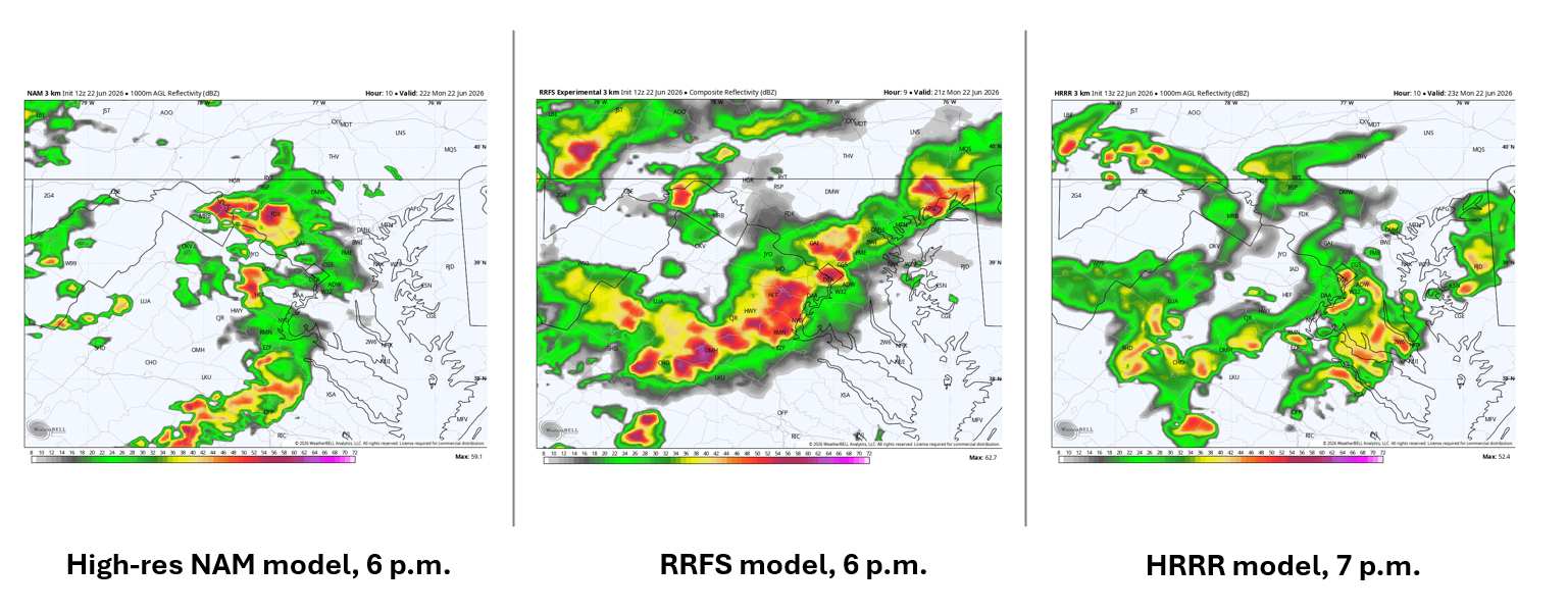
Computer simulations vary somewhat on how widespread the storms will be but generally show at least scattered activity during the late afternoon and early evening. One important factor will be the amount of cloud cover, which could limit heating and keep the atmosphere from becoming fully unstable.
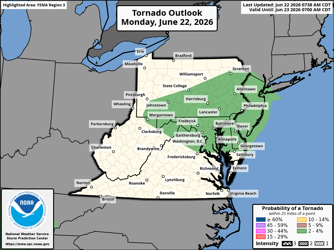
The tornado threat stems from elevated wind shear — changes in wind speed and direction with height — which could help some storms rotate. The DC area lies on the southern edge of the zone with an increased tornado risk. That risk may be somewhat higher across northern Maryland and southeastern Pennsylvania, where a nearby warm front could enhance storm rotation.
There's a good chance a severe thunderstorm watch will be issued for the region today. We'll post updates if a watch is issued and as storms develop.


