



Yesterday's break from the humidity – if you want to call it that – didn't last long. The atmosphere is once again juiced and has the potential for to produce heavy rainfall today.
The most likely timing for storms is between 3 and 8 p.m. from west to east, and probably between 4 and 7 p.m. in the Beltway area.
The DC area is under both a flood watch and a level 2 out of 5 risk of severe thunderstorms this afternoon and evening. A few damaging wind gusts are possible in addition to heavy rain and lightning.
Here's what the National Weather Service writes about the flood risk:
With a continued tropical air mass over the area, very heavy rainfall rates are possible in many of these storms. These rates could approach 2 to 3 inches per hour, with higher instantaneous rates possible. The most vulnerable locations would be urbanized areas along I-95 as well as areas which have experienced heavy rainfall in recent days.
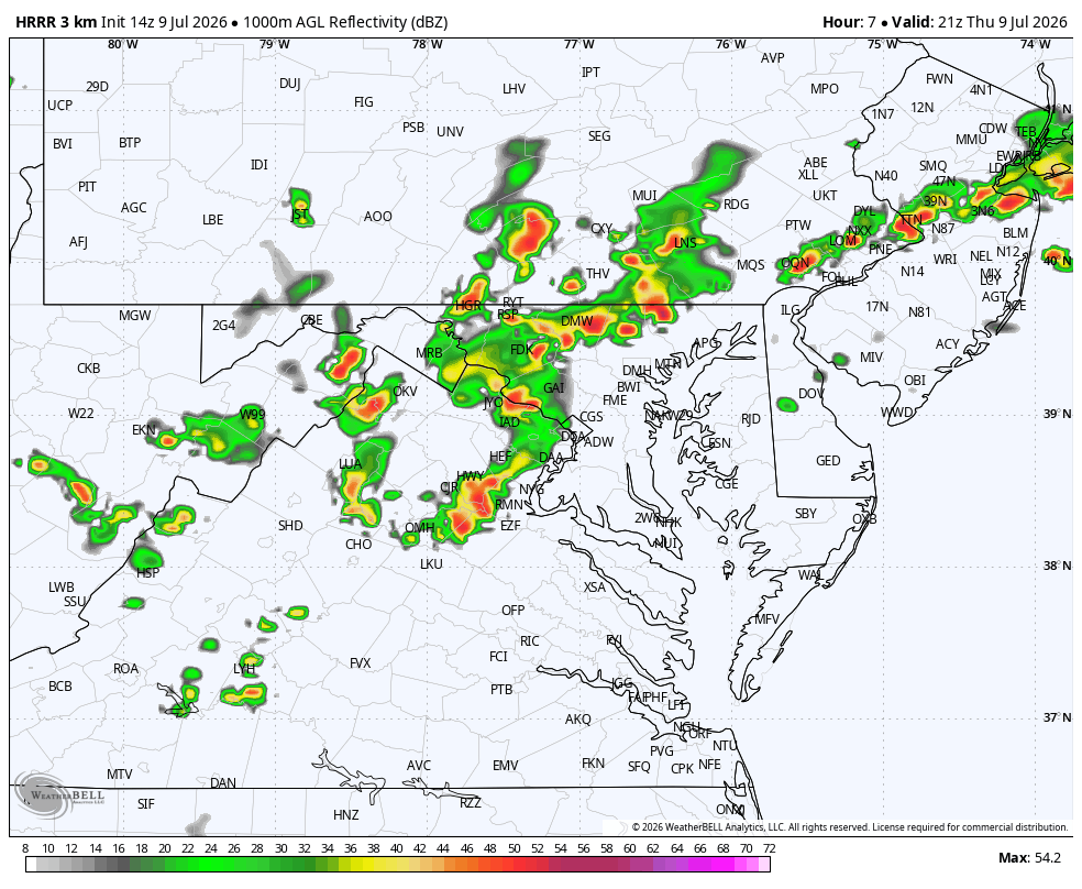
The trigger for today's storms is an atmospheric disturbance moving east from Tennessee and Kentucky into an environment rich in tropical moisture.
As with many of the storm setups over the past week, some areas will be hit much harder than others, and rainfall totals will vary widely. That said, computer models suggest today's storms may be more widespread than on recent days, when activity tended to be more scattered.


