



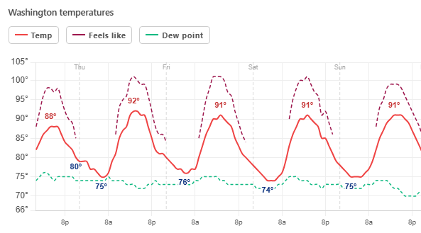
Temperatures are relatively subdued today, with highs in the 80s. But the next three days – Thursday, Friday, and Saturday – are all hot and humid with highs near 90 to the low 90s, and the afternoon heat index peaking in the upper 90s to near 100.
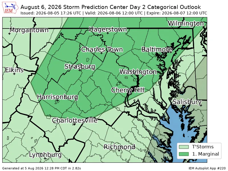
Each day has a chance for isolated to scattered showers and storms midafternoon into evening. In general, it looks like the chance that any given location will see a storm is around 25 to 35 percent late Thursday, and around 45 to 55 percent Friday and Saturday.
With the higher heat, juiced atmosphere (dew points around 70 to 75), and a strengthening jet stream, a few storms the next few days could be heavy rainers with some potential for isolated flooding and damaging wind.
Sunday is still hot and humid, with highs near 90 to the low 90s, and the heat index peaking in the upper 90s to near 100. Can't rule out a shower or storm on Sunday as well, but chances are probably lower than the previous days with a bit less moisture in the atmosphere.


