



Expect a turbulent afternoon and evening as waves of showers and thunderstorms, some severe, sweep through the area. Damaging wind gusts capable of bringing down trees are the primary hazard.
The first round of storms could arrive between 3 and 6 p.m. and may be the most intense. While scattered, storms will have the potential to unleash torrential rain, frequent lightning and microbursts — intense, localized downdrafts. Large hail and even a brief, isolated tornado also can't be ruled out.
The severe threat may be somewhat limited if skies remain mostly cloudy, since sunshine and daytime heating help fuel stronger storms. In addition, the tornado threat is expected to be greatest north and northeast of our region, closer to a northward-moving warm front where atmospheric spin will be enhanced.
The National Weather Service has placed the area in a Level 3 out of 5 risk for severe storms. The setup features a strong disturbance moving through the upper-level flow, while high humidity will provide ample fuel for storm development.
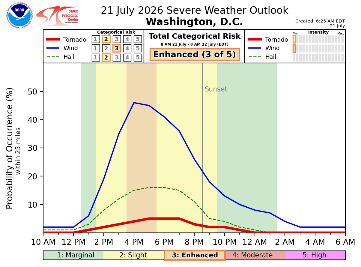
The Weather Service estimates the following chances of hazards occurring within 25 miles of any location:
- Damaging wind gusts: 45%
- Large hail: 5 to 15% (highest chances north and east of DC)
- Tornadoes: 2 to 5% (highest chances north and east of DC)
Because the atmosphere is exceptionally humid, torrential rainfall is another concern, and localized flooding is possible. The risk will be heightened if multiple rounds of storms move over the same areas.
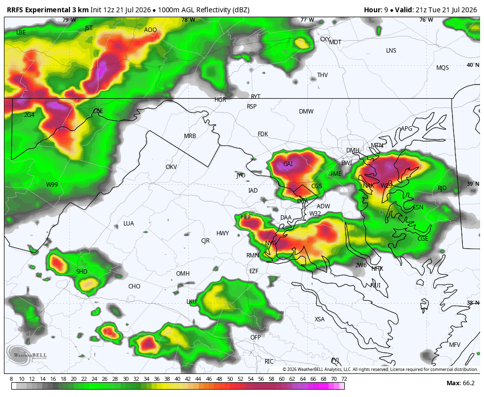
After the first round in the late afternoon and early evening, computer models show additional showers and storms sweeping through later in the evening, after sunset. Most of the activity should wind down by around midnight.
These later rounds probably won't be as intense as the first, but a few storms could still become severe.
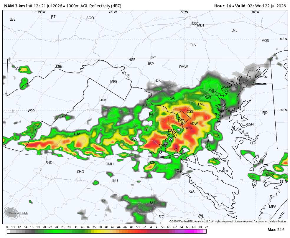
As is usually the case with thunderstorms, some areas will be hit much harder than others, while some locations may be skirted or even missed altogether. Rainfall totals could easily reach or exceed 0.5 to 1.5 inches where the heaviest storm cells track.
We expect severe thunderstorm and/or tornado watches to be issued for parts of the region and will post updates throughout the day. Stay tuned.


