


Computer models have come into strong agreement that next week's heat wave in the DC area will be unusually intense and dangerous. Highs are forecast to surpass 100 degrees on multiple days and could flirt with the all-time record of 106.
Thursday and Friday are expected to be the hottest days, but it may remain uncomfortably hot into the July 4 holiday weekend. This heat will pose health risks, especially for people spending extended time outdoors or without reliable access to air conditioning.
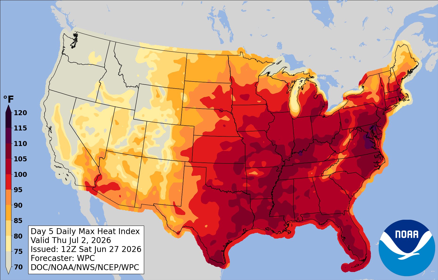
Factoring in humidity, heat indexes — a measure of how hot it feels — will probably peak near or above 110 degrees Thursday and Friday. The National Weather Service will very likely issue excessive heat warnings.
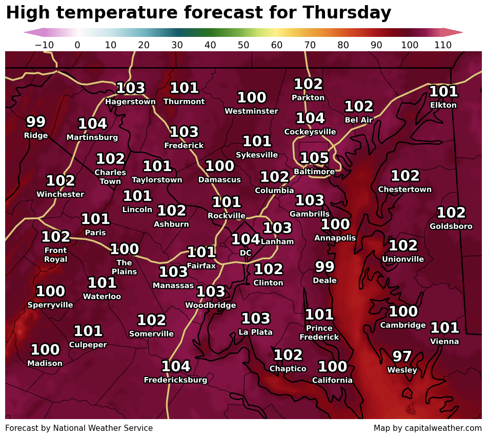
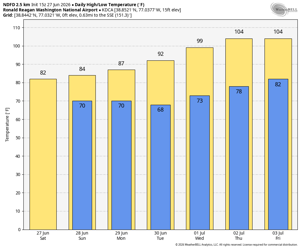
The Weather Service is already highlighting a "prolonged significant heat risk" for the DC area from Tuesday through the weekend. Its forecast highs of 104 degrees on Thursday and Friday would set records for those dates and come within two degrees of DC's all-time record high of 106.
Between Thursday and Saturday, overnight lows will probably only fall to around 80 to 85 degrees near downtown, also threatening records. The lack of overnight cooling is a major health concern, particularly for people without housing or access to air conditioning.
Some computer models are simulating highs as extreme as 105 to 110 degrees, but they have a known tendency to overestimate temperatures several days in advance. Even so, the potential for exceptional heat is greater than usual because of the ongoing drought. Dry soils allow more of the sun's energy to heat the air rather than evaporate moisture from the ground.
It's not yet clear exactly when the heat will break. Earlier this week, it appeared temperatures might ease by July 4. Now, however, forecasts suggest highs could flirt with 100 degrees on the holiday before cooler weather arrives Sunday.
When the heat finally does break, strong to severe thunderstorms are possible, perhaps as early as July 4.
"Historically, near-record summer heat often ends with widespread strong thunderstorm activity, and latest guidance starts to break down the heat next weekend," the Weather Service cautioned.
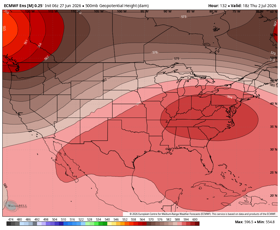
The culprit behind this heat wave is an intense area of high pressure — often called a heat dome. It is forecast to build over the Southeast on Monday before expanding into the Mid-Atlantic from Tuesday through Friday. Over the holiday weekend, it will probably begin shifting back toward the Midwest.


