


There was no change in the drought classification across the DC area in this week's update from the U.S. Drought Monitor. There was also little to no rain, a defining characteristic of a fourth-driest June to date, one drier than any seen in the District in eight decades.
Extreme drought, the second-worst category from the monitor, increased its coverage somewhat in southern Maryland to now encompass all of St. Mary's County. More of the Delmarva Peninsula also moved into extreme drought, with most of that region now included in that category.
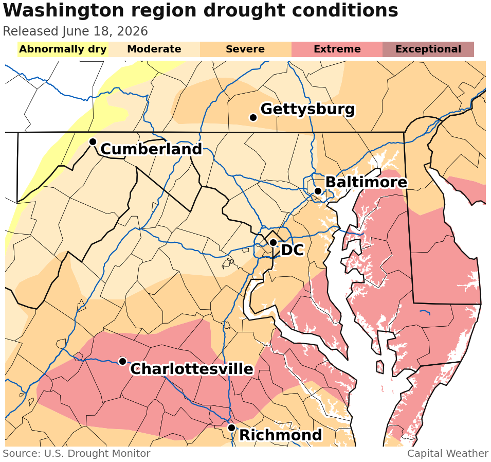
Despite little official change nearby this week, the situation this month has been far from good news for moving the needle away from drought. DC has picked up only 0.21 inches of rain, which is 2.25 inches below normal, and no June has been drier since 1940, the record holder to date with 0.11 inches.
This comes during a month that is the second-wettest of the year in the District, averaging 4.20 inches from start to finish. And, as Jason Samenow highlighted for friends and founders in Thursday's newsletter, we're missing about a foot of rain over the last year.
Both the more reliable weather models and the experts at the National Weather Service expect precipitation to be at least somewhat above normal over the next week to 10 days.
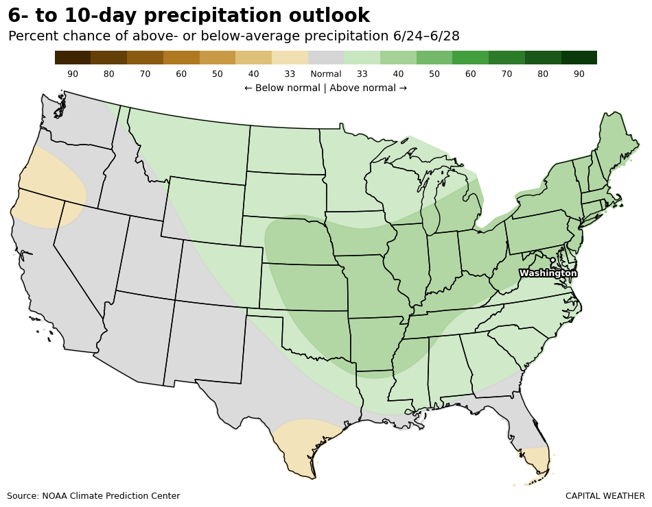
While the next few days will be largely or fully dry, Monday appears to bring a chance for relatively substantial rainfall — perhaps also strong storms — on the order of half an inch or more for places that cash in.
Keep in mind, the saying goes something like, "When in drought, leave it out," and plenty of recent rain chances have evaporated as their time arrives.


