


On a day like Wednesday, with lots of sun, low humidity, and somewhat below-average temperatures, it's hard to wish for more rain, but we could still use it. Our next chances arrive late week.
The culprit is a cold front working this way from the central United States. It'll slow down and weaken as it reaches our region, so specifics are still a bit up in the air.
Here's a quick breakdown of what we know, by day:
- Friday: Seasonably toasty and humid, with scattered showers and storms developing late in the day to the west and southwest. These storms could work across the area into evening, with an isolated chance of damaging wind gusts.
- Saturday: Probably not a washout, but additional waves of rain are possible, along with a few storms. Clouds probably keep temperatures in check, or a handful below the mid- and upper 80s norm.
- Sunday: More of the same to end the weekend. Clouds tend to win out over sun much of the day, with at least a wave or two of showers and storms possible. Perhaps another elevated chance of late-day storms.
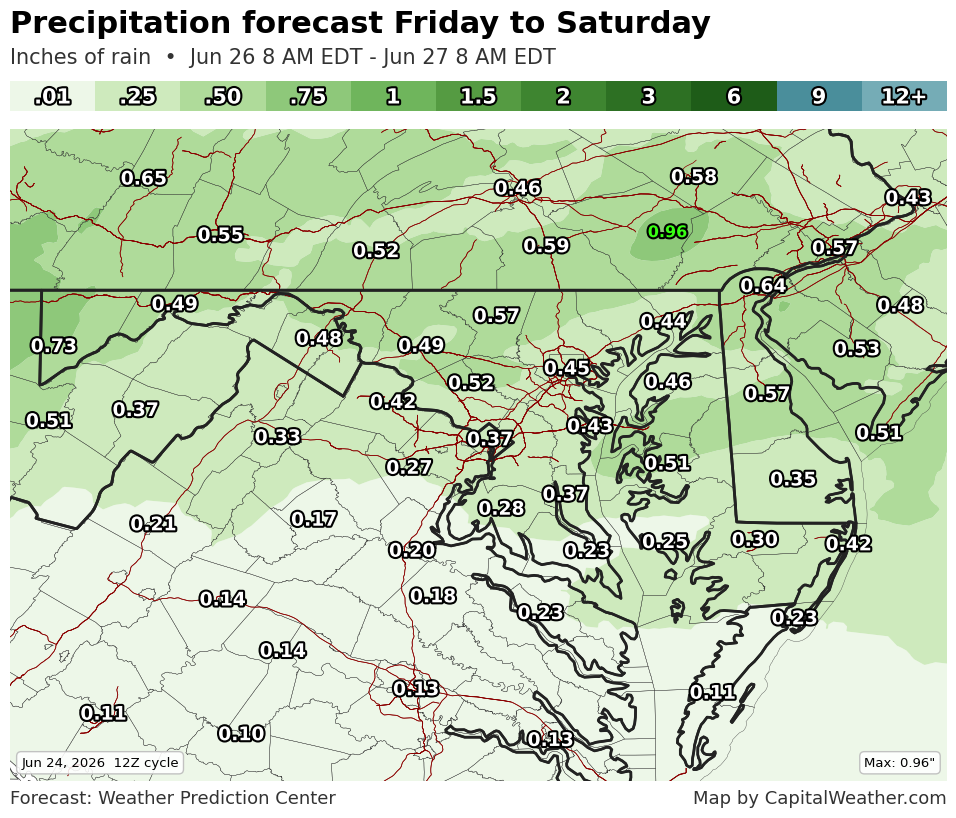
This presently seems like the type of rain that drops around half an inch to 1 inch, with up to 2 inches or more in places that see repeated downpours.
Rain odds should diminish a bit into next week with high pressure building, but we'll need to keep an eye out for the potential of "ridge rider" storms that like to travel the edges of summertime high-pressure systems.


