



The heat wave that gripped the DC area from July 2 through 4 ranked among the five most intense on record. Another round of dangerous heat is on the way this week, bringing the possibility of more triple-digit temperatures.
The hottest days will be Wednesday and Thursday, when highs could flirt with 100 degrees before gradually easing into the weekend. There's even an outside chance Wednesday could challenge the record high of 102, set in 2024.
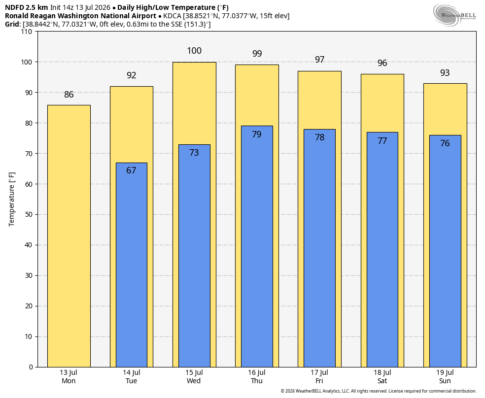
This heat wave won't be quite as intense as the one earlier this month, when highs reached 102, 102 and 103 over three consecutive days.
Humidity should also be a bit lower. Dew points — a measure of atmospheric moisture — are forecast to average in the mid- to upper 60s, compared with the low 70s during the previous heat wave.
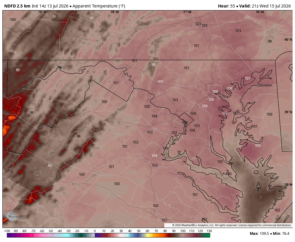
Even so, it will still feel oppressively hot. Factoring in the humidity, heat index values could climb to around 105 degrees on Wednesday, likely prompting heat advisories.
The culprit is a sprawling heat dome — a strong area of high pressure — that will extend from the Dakotas to the Mid-Atlantic on Wednesday.
This same heat dome has fueled exceptional heat across the West. It helped produce Montana's highest temperature on record, 118 degrees, on Sunday, and contributed to Salt Lake City's all-time record high of 109 degrees.
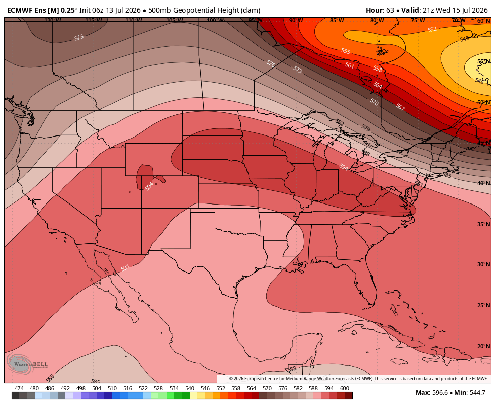
The heat dome is forecast to gradually weaken and retreat south and west later this week, allowing a cold front to approach the East Coast. That should bring a gradual easing of the heat heading into the weekend.


![Q&A: Near-record heat possible Wednesday. Enjoy tamer warmth beforehand! [Sundays@7 Live Chat]](https://storage.ghost.io/c/9b/2a/9b2aed80-72a3-473a-aaf8-035d8a6ee8cb/content/images/size/w960/format/webp/2026/07/Screenshot-2026-07-12-at-19.06.34.png)


