



Much of this week is dominated by a strong "heat dome" of high pressure to our west that will expand into the region. It delivers another shot of dry conditions and extreme heat, including temperatures potentially reaching the century mark yet again.
After flexing into the Mid-Atlantic mid- and late week, the heat dome will retreat westward. As it does so, we'll end up near its edge, a prime spot for "ridge riding" thunderstorm complexes that are common in midsummer.
A lot of questions remain.
"Forecast confidence decreases substantially late this week into the upcoming weekend, but the potential is there for both extreme heat and severe thunderstorms," the National Weather Service wrote in a discussion today.
One major question is the location of a frontal boundary late week into the weekend. To its north, fairly cool temperatures in the 70s and 80s. To its south, readings are often near or past 100. Any storm complexes forming in that time frame will seek the hotter and more humid air, so the location of the front is critical.
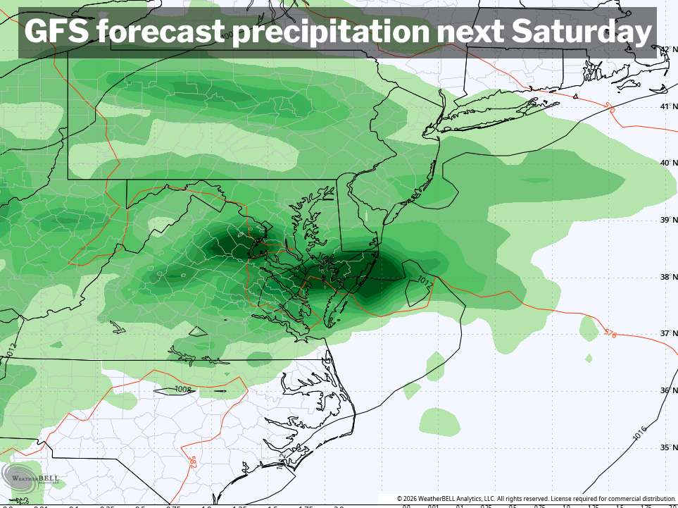
Since this is all subject to subtle changes in the location of the heat dome and jet stream winds surrounding it, we're too far out for details. However, it seems like anything scattered about on Friday would be an opening salvo of up to several days of storm risks. There's even a smaller chance of an isolated storm Thursday, but unclear if anything will form.
Better odds of showers and storms look to arrive for the weekend — of course! Saturday presently has the best chance of more widespread activity, including the potential for heavy rain. The front may then try to sink south again by Sunday, and more certainly by Monday.


![Q&A: Near-record heat possible Wednesday. Enjoy tamer warmth beforehand! [Sundays@7 Live Chat]](https://storage.ghost.io/c/9b/2a/9b2aed80-72a3-473a-aaf8-035d8a6ee8cb/content/images/size/w960/format/webp/2026/07/Screenshot-2026-07-12-at-19.06.34.png)


