



With 0.65 inches falling officially, Thursday was the wettest day in DC since June 22. At other nearby locations, 1.44 inches was recorded at Dulles Airport while 1.01 inches fell at BWI Marshall.
That distribution is something of a common story of late — heavier rain north and south, or east and west, of DC.
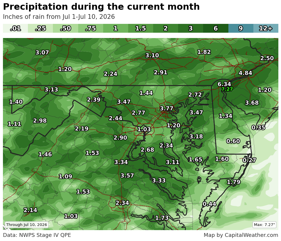
Month to date, the District is about 0.3 inches below normal, with 1 inch of precipitation through Thursday. Dulles is 1.5 inches above normal, and BWI has picked up 3.39 inches, or more than 2.2 inches above typical through July 9.
Much more of the area is above average than below over the last 10 days to two weeks or so. Damascus, Maryland, has seen rain on all of the last six days and is 1.74 inches above average.
Despite the recent rains, the main change in Thursday's weekly Drought Monitor update was to add additional severe drought to far western suburbs. This includes portions of western and northern Loudoun County, as well as places northwest of that.
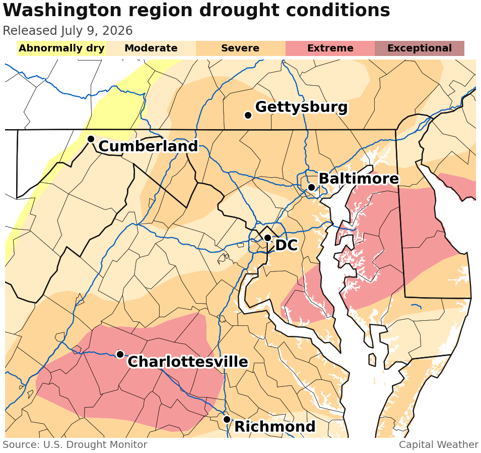
Drought's staying power in the face of rain is heavily attributable to 12-month rainfall deficits of 10 to 18 inches in much of the region.
After scattered showers Friday and Saturday, raindrops will probably be harder to come by for a while. With another round of high heat on the horizon next week, the rainfall forecast for the next seven days is pretty paltry. Verbatim, it would be a well-below-average week near the wettest time of year.


